Why is this petition important? Sign here: https://actionnetwork.org/petitions/st-vincent-de-paul
- Development is inappropriate in primary surge zone;
- Where will services be provided from during storm surge?
- Application doesn't demonstrate there is no link between anti-social behaviour in Stuart Park and the existing Ozanam House;
- Impact on safety of other bus users;
- No formal traffic assessment undertaken or provided, and should be required;
- Ability for aging road and pedestrian infrastructure to cope with increased demand;
- Concerns regarding potential for emergency vehicle access
- Permanent facility should be developed elsewhere, with no need for interim option;
- Proposed land use is incompatible with surrounding residential and commercial land uses;
- Proposed land use is not appropriate in residential / commercial area;
- Subject land is in close proximity to a number of premises with Liquor Licenses, including within walking distance of the Nightcliff BWS;
- Subject land is 200 metres from supermarket and bottle shop;
- Lack of Community Consultation;
- Exhibition Signs were not noticed;
- 14 days is insufficient time to respond.
- What measures are in place to provide transport, services, shelter and ensure security for / from users outside of operating times?;
- Intended transport to where people are staying is contradictory to intention to provide service to homeless;
- Clearing of native vegetation is not
appropriate;
- Will adversely impact local fauna species and reduce potential for vegetation to mitigate impacts from flooding and storm surge, including soil erosion;
- Nothing in application to limit time period to 3 years.
- Scepticism that proposed facility will be temporary.
Posted in Current Campaigns
Overview
PLan: the Planning Action Network Incorporated Inc collaborates with resident and community groups on matters including the built environment, heritage, cultural and environmental values of concern in the Northern Territory and Australia. PLan’s aim is to achieve, for the community, sustainability in terms of social, cultural, environmental and balanced long term economic impacts.
This is a great opportunity to gain office and IT skills.
Applicants would benefit from, but not necessarily require experience in:
Office administration, document preparation and event planning.
Attributes that would assist in you carrying out your duties:
A desire to influence change in the positive, a strong sense of place, capacity to enable community and an understanding of the history of the Territory’s built environment.
This position is unpaid and arrangements are by negotiation. A commitment to a minimum number of hours per week would be required.
Our office is located at Raffles, 8/1 Buffalo Court Darwin NT 0800.
For more information, please email at This email address is being protected from spambots. You need JavaScript enabled to view it. or call 0447 499 794
Under the guidance of the Convener the volunteer will:
- Deal with information relevant to Plan’s goals
- Gather materials and prepare reports on gathered information
- Prepare and enter materials into the online archive
- Update internet facing assets
The volunteer will have the opportunity to participate in community and other meetings.
For more information, please email at This email address is being protected from spambots. You need JavaScript enabled to view it. or call 0447 499 794
www.planinc.org.au
Posted in Blog & Opinion
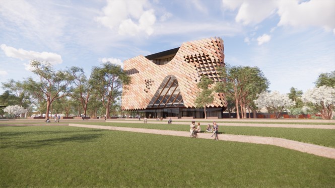
A first look at the National Aboriginal Art Gallery is available
MASTERPLAN SA PTY LTD
Proposed Development:
Exhibition Centre with Ancillary Place of Assembly
PA2024/0053 has an exhibition period of Friday, 8 March 2024 - Midnight Friday, 5 April 2024 when it has been placed on public display this morning 22/3/24, PLan are following up.
https://www.ntlis.nt.gov.au/planning-notices-online/notices#/index
Posted in Community Alert
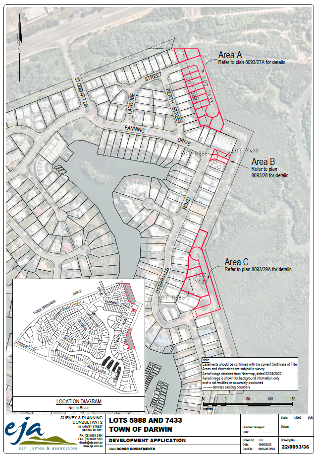
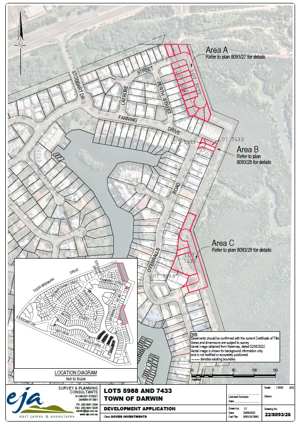
There is a current Planning Notices/Development Applications NT further application by Earl James and Associates to develop land at Bayview.
It includes a proposed rezoning of some land. Total to create 19 lots.
The application is similar to the previous one using marginal land, but adding a proposed rezoning of some currently FD (Future Development) land as well.
Here is the reference number to the full proposal: PA 2023/0327 Concurrent Application. Dates for submissions 8 March to 5th April, 2024.
Area B, Part of Lots 5988 and 7433 - 116371539_8093-28_2022-09-29.pdf
116371541_EJA_8093_Amendment_Proposal.pdf
Area A, Part of Lots 5988 and 7433 - 116371543_8093-31A_2023-08-09.pdf
Area A, Part of Lots 5988 and 7433 - 116371545_8093-27A_2023-08-01.pdf
Area B, Part of Lots 5988 and 7433 - 116371547_8093-32_2022-11-17.pdf
Area C, Part of Lots 5988 and 7433 - 116371549_8093-29A_2023-08-01.pdf
Area C, Part of Lots 5988 and 7433 - 116371550_8093-33A_2023-08-09.pdf
116371553_EJA_8093_Development_Proposal.pdf
Area B Driveways, Part of Lots 5988 and 7433 - 116371555_8093-34B_2022-11-16.pdf
Area A Driveways, Part of Lots 5988 and 7433 - 116371557_8093-37-A_2023-09-18.pdf
Area C Driveways, Part of Lots 5988 and 7433 - 116371560_8093-37-B_2023-09-18.pdf
Development Application - 116371562_8093-36_2023-09-18.pdf
Proposed Zones - 116371563_8093-39-2023-09-18.pdf
116371568_Att_C_Master_Services_Plan.pdf
116371569_Att_A_Locality_Plan.pdf
116371572_Att_D_Cadastral_Boundary_Plan.pdf
116371574_Att_D_Cadastral_Boundary_Plan.pdf
116371577_Att_G_Street_Lighting_Plan.pdf
116371579_Att_H_NBN_Plan.pdf
116371581_Att_F_Erosion_and_Sediment_Control_Plan.pdf
116371584_Att_I_Electrical_Reticulation_Plan.pdf
116371586_Att_B_Lot_Layout_and_Typical_Section.pdf
116371589_Att_J_DP_Geotechnical__Assessment_Lot_A_and_C.pdf
116371591_Att_K_Traffic_Impact_Assessment.pdf
116371597_8093-36_overall_plan.png
116371599_Att_E_Stormwater_Management_Plan.PDF
Posted in Community Alert
City of Darwin, in collaboration with local architect firm Hames Sharley, have opened a stakeholder and community engagement process for the development of a masterplan for Bundilla Beach which will deliver a comprehensive plan for the area including short, medium and long terms goals.
Consultation closes at 11:59pm on Sunday 12 November 2023, with construction of the first stage of the masterplan scheduled for delivery in 2024.
It is of concern that the concept documents for stage one of the Master Plan are not to be found.
It is also of concern that the significant community consultation held in 2016 and the results have been ignored.
Take action
We encourage members of the public to:
A) Get informed and then complete the online survey here: https://engage.darwin.nt.gov.au/bundilla-beach-masterplan
B) Contact your Local Member of Parliament, Councillors and City of Darwin
- Mr Brent Potter MLA, This email address is being protected from spambots. You need JavaScript enabled to view it. - (08) 8999 6437
- Mr Morgan Rickard Clr, This email address is being protected from spambots. You need JavaScript enabled to view it. - 0483 129 394
- Mr Ed Smelt Clr, This email address is being protected from spambots. You need JavaScript enabled to view it. - 0448 914 933
- Mr Peter Pangquee Clr, This email address is being protected from spambots. You need JavaScript enabled to view it. - 0499 417 632
C) Have your say at the Consultancy pop up stalls
D) Come to PLAN Stall at Parap Markets on 28/10/23
2016 Community Consultation
In 2016 Vesteys Reserve (now Bundilla Park) Community Consultation was held, see this link Vesteys_Beach_Consultation_2016.pdf
Note the use of Community Workshops and one-on-one discussions with stakeholders.
The consultation ran for eight weeks from 17 June to 12 August 2016
A community consultation process was carried out by Michels Warren Munday to hear from the community and stakeholders on their experiences, views and aspirations for the future use of Vesteys Reserve.
There were 405 online surveys completed, 45 written and verbal submissions, a community workshop with approximately 50 participants and one-on-one discussions with 19 stakeholders and local residents
The consultation findings have been categorised into three key areas: Knowledge and values, Issues and Future vision.
The strongest message from residents and stakeholders was that any future development on Vesteys Reserve must be in line with the current public open space zoning (so no residential or large scale commercial development), and that the public should maintain access to this valued open space.
To return to the current process
NOTE: At time of writing the advertised link to the Master Plan is broken, please email This email address is being protected from spambots. You need JavaScript enabled to view it. and This email address is being protected from spambots. You need JavaScript enabled to view it. requesting that the link be made good and an extension of time be granted due to members of the public being unable to access the document(s) under review. There is no available detailed description of stage one as far as PLan can tell.
Members of the public are concerned that this new masterplan is a takeover and is a most unfortunate development for the community.
In order to prevent the commercialising of the foreshore, the community and particularly the local residents and independent other people, who use the foreshore, including members of the public, must continue to be strongly involved and speaking up.
Apart from other issues, this area of foreshore should be full of natural variety so that it is a environmental asset for teaching by the two schools which adjoin it.
In the survey
Question 6 - where is the rational for the group of suggestions?
Do you think the following proposed deliverables designed for the immediate upgrade of Bundilla Beach meet your aspirations and needs?
additional public lighting
3 x 3 basketball court
greenspace irrigation
additional BBQ tables and shelters
street food enabling infrastructure
additional toilets
improvements to pathways
improvements to parking
a RV dump point.
1. Yes
2. No
3. Other (please specify)
Question 8
Now no mention of the RV dump Point, should members of the public be able to place it last if we chose?
Posted in Current Campaigns
Quick notes for ABC Radio interview 20/10/23
Ok, they have paid $14k a year to hold 85 hectares of Lee Point for 16 years, it seems no one from crown land ever insisted the course should actually be built.
in 2020 members of the public picked up on the lease is up for renewal, so began enquiries. The answer from NTG was nope the lease holders will get the land, don't bother apply for the lease renewal.
The leaseholders have been meeting with members of the public explaining their plans for the site. We get 14 says to study over 400 pages.
Lee Point is now a national issue. DHA have not shown how they are meeting the original environmental requirements for that adjoining development.
To the golf course, at $1m per hole the course is a very expensive undergoing for a city with multiple golf courses. With global warming will people be playing golf in Darwin in 10 years’ time?
There is mention of a mini golf course as part one. Is it reasonable that NTG should only release that much land? The lease calls for the first 9 holes to be constructed in a year. When that is built then the next stage can be looked at. Meanwhile let’s rehabilitate the land. This area is known for attracting flocks of Gouldian Finches. We need extensive planting of Darwin bloodwoods for tree hollows.
115 ha
The subject land has the following areas and road frontages: • Lot 9461 - an area of 85.79 ha and a frontage of approximately 667 meters to Buffalo Creek Road. Access to the golf facilities on Lot 9461 will be provided from a section of the side boundary of Lot 9289 which faces onto Buffalo Creek Road (in the north-east corner of Lot 9289). • Lot 9289 - an area of 29.59 ha and a frontage of approximately 775 meters to Lee Point Road which provides access to the caravan and camping park and hotel development.
Current lease terms
DATE REGISTERED Commencement Date: 28 March, 2019 Expiry Date: 27th March, 2023 LEASE GRANT/PURPOSE Crown Lands Act (and the Regulations) The development of a Golf Course and any ancillary uses; Lots 9461 + 9289 Town of Nightcliff to create one lot (subject to 'the Act' the Lessee will not use the Land for a purpose other than the Lease Purpose). The Lessee must, within 2 years from the Commencement Date obtain necessary approvals, licences, consents pertaining to the NT Planning Scheme and Planning Act. Must within 4 years develop a Golf course (Certificate of Compliance?)
Lease terms over the years
CROWN LEASE TERM 973 Lot 9461 Town of Nightcliff from plan(s) S 93/239 Area under title is 85 hectares 7900 square metres.
23/07/2018 906760 Correction to Register - Tenure Status changed from () to (K) 13/04/2017 885984 Variation - term extended to 16/04/2018 21/03/2016 866549 Variation - term extended to 16/04/2017 17/03/2015 845394 Variation - term extended to 16/04/2016 19/03/2014 818300 Variation - term extended to 16/04/2015 26/03/2012 768257 Variation - conditions varied and term extended to 16/04/2014 12/12/2008 688161 Variation - conditions varied End of Dealings Commencement Date: 17th April 2007 Expiry Date: 16th April 2018
1. The purpose of the lease (the lease purpose) is 18-hole golf course, associated recreational uses and sewerage treatment ponds. 2.The annual rent for the lease (called the rent) will be $14,181.82 (fourteen thousand one hundred and eighty one dollars and eighty two cents) (GST Inclusive) subject to lease conditions 6,7 and 8.
2. The Lessee will within six months from the date of commencement of the lease or within such further time as may be approved in writing by the Minister for that purpose commence development of the first nine holes of the golf course in accordance with the lease purpose on the leased land to a value of not less than the sum of $1M (one million dollars) and the Lessee will complete the physical construction of the first nine holes of the golf course to a value of not less than the said sum within eighteen months of commencement of the lease or within such further time as may be approved in writing by the Minister.
3. The Lessee will within 18 months from the date of commencement of the lease or within such further time as may be approved in writing by the Minister for that purpose, commence development of the second nine holes of the golf course in accordance with the lease purpose on the leased land to a value of not less than the sum of $1M (one million dollars) and the Lessee will complete physical construction of the second nine holes to a value of not less than the said sum within thirty months of commencement of the lease or within such further time as may be approved in writing by the Minister. 4. The Lessee will within nine months from the date of commencement of the lease or within such further time as may be approved in writing by the Minister for that purpose, commence construction of the sewerage ponds to service the golf course and the caravan park and motel development on adjoining Lot 9289, Town of Nightcliff, in accordance with the lease purpose on the leased land and the Lessee will complete the construction of the sewerage ponds within eighteen months of the date of commencement of the lease or within such further time as may be approved in writing by the Minister. 5. The Lessee will within one year from the date of commencement of the lease or within such further time as may be approved in writing by the Minister for that purpose, commence landscaping associated with the development and the Lessee will complete the said landscaping within three years and six months of the date of commencement of the lease or within such further time as may be approved in writing by the Minister.
11. The Lessee shall in respect of the land included in the lease, ensure that at all times and to the satisfaction of the Minister, the land is kept clean, tidy and free of weeds, debris, dry herbage, rubbish, carcasses of animals and other unsightly or offensive matter and harbour for insects, pests and the breeding of mosquitoes.
Conditions Varied: LTO Instrument 688161 registered on 12th December, 2008 to existing conditions. Delete Condition 2 and replace with: "2. The Lessee will within one year from the date of commencement of the lease or within such further time as may be approved in writing by the Minister for that purpose, commence to erect improvements in accordance with Condition 1 on the leased land, to a value of not less than the sum of one million dollars ($1M) and the Lessee shall complete the erection of the said improvements to a value not less than the said sum by 16 April 2011 or within such further time as may be approved in writing by the Minister. Delete Conditions 3, 4 and 5. LTO Instrument 768257 registered on 26th March 2012.Variation to condition 2 by deleting "by 16 April 2011" and replace with "by 31 December 2013." Variation to condition 7 by deleting "within four years of that date" and replace with "by 31 December 2012." Variation to condition 8 by deleting "within four years of that date" and replace with "by 31 December 2012."
An 18-hole golf course in two stages and including a driving range, putting & chipping greens. b) Support facilities including pro shop, player amenities such as toilets, locker rooms, kiosk and future Golf Club House building (likely in stages). c) Maintenance and golf cart storage facilities. d) A Mini-Golf course including support facilities such as toilets, storage areas, outdoor seating dining areas, locations for food vans etc. e) Associated access and carparking areas.
Initial estimates of the project value including the development of Mini-Golf, Golf Courses, Pro-shop and Golf Clubhouse suggest a project value of approximately $20million. This will need to be confirmed once more detail is obtained.
The areas of the Site as proposed for this development application are zoned -Organized Recreation (OR). Refer Clause 4.18 NT Planning Scheme 2020 – extract below with associated definitions.
Features of the landscaping master planning for the site include: • The retention of the sensitive rainforest area in the southeastern corner of the site. • Revision to the original golf course layout to allow additional natural revegetation to the area adjacent to Dam 1 and along the southern boundary of the site to provide a wildlife corridor – an area where sightings of the Gouldian Finch have been made in recent years. • Significant areas of the site including areas between the proposed golf fairways with retained or generally naturally revegetated landscaping. • The retention of existing natural vegetation and revegetation with mainly natural species on the site to minimize the water requirement across the majority of the site. • Use of recycled effluent and harvested natural stormwater runoff of the site collected into the 3 dams and providing the source of water for the site irrigation – thus providing a sustainable water usage for the site.
The environmental provisions made within the golf course development for increased natural landscaping (trees and appropriate areas of grassland) – particularly on the southern side of the site and adjacent to the dam in the SW corner of lot 9461. Refer to the updated EMP in Appendix D and the Concept Landscaping Plan in Appendix G.
Posted in Current Campaigns
Sign the petition here: https://actionnetwork.org/petitions/bundilla-rv-park-proposal/
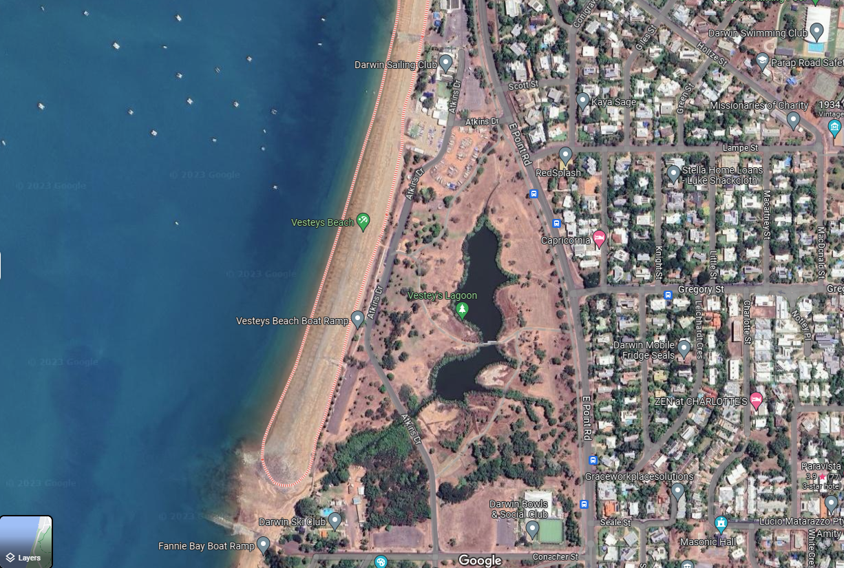
Bundilla Beach, previously known as Vesteys Beach, is an open, green space area of natural biodiversity with a large lagoon attracting a range of birds and wildlife on the edge of Darwin’s CBD. It is a peaceful place that attracts nature lovers, birdwatchers, local fishermen, cyclists, walkers and sunset viewers.
Hugging the foreshore it is linked via a public access concrete walking path to East Point Reserve on the one side and Mindal Beach on the other or via the beach at low tide.
Bundilla is a Larrakia language word meaning 'girl' or 'young woman'. On 20 March 2010 Vesteys Beach and a nearby creek, was renamed Bundilla Beach and Bundilla Creek respectively. The renaming to Bundilla recognises the continuing cultural significance of this site to the Larrakia Aboriginal people.
Vestey's Meatworks, officially the North Australia Meat Company, was a slaughterhouse in Darwin, Northern Territory, Australia, built by Vestey Brothers between 1914 and 1917. Never profitable, it operated for three years before the company abandoned the venture in the aftermath of the Darwin rebellion. Most of the facility was demolished in 1957, but two large water tanks remain standing today, on what is now the site of the Darwin High School on Bullocky Point in the suburb of The Gardens. The beach to the north of Bullocky Point is called Vestey's beach as a result of the meatworks. (Source Wikipedia)
This Petition is in response to the public announcement in April 2023 by the Lord Mayor of Darwin Hon. Kon Vatskalis, that he is planning to trial a commercially run RV Park on the foreshore of Bundilla Beach which is public land.
See below for images and more information.
Below is from the previous public meeting.
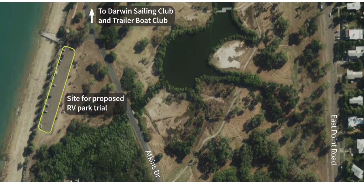
Darwin council is seeking public feedback on trialling a recreational vehicle park near Bundilla Beach (Vesteys Reserve) in Fannie Bay.
The consultation is online and closes 3 pm Friday 12 May 2023.
This is an abrupt about face on the use of this public space. In a recent survey community strongly indicated they were for preservation of the status quo in this area.
HOW CAN YOU HELP?
Visit the council site and read the Frequently Asked Questions, tell your neighbours and friends.
Visit
Planinc.org.au search Bundilla for current information. https://planinc.org.au/14-events/317-bundilla-beach-rv-park.html
Take the survey
https://engage.darwin.nt.gov.au/recreational-vehicle-park-trial-at-bundilla-beach
Contact
Local MLA Electorate Office – Hon Brent Potter and City of Darwin Counselors, Amye Un, Mick Palmer and Paul Arnold.
RALLY - Public Meeting Sunday 7th May 5:30pm at Vesteys Beach Car Park, all welcome.
Here are some of the items of concern:
Council says: We’re committed to working with local businesses and industry to advance the Darwin economy. Implementing this trial would provide more accommodation options near the CBD in Darwin’s busy 2023 peak visitor period and is expected to support local businesses, creative industries and the visitor economy.
How does this trial support creative industries? This type of accommodation was removed from the inner city area and NTG have allowed, with no apparent objection by Council, the closure of the Malak caravan parks which have been rezoned into residential. If we are committed to van life then why allow closure of existing parks.
Council says: There will be a dump point installed during the trial period with costs borne by the successful applicant. Recreational vehicles using the space would be self-sufficient regarding water, washing, showering, and cooking needs.
What is a dump point? Toilets/showers/Rubbish
Council says: A caretaker being onsite would be dependent on the operator’s processes. In other words there may not be a caretaker.
Who is ensuring good behaviour and that wildlife is not encroached on by dogs/cats etc. Will the booking system require restricted access to the space? How will residents be able to park and use the area for dog walking and fishing? Will access through to the High School be maintained?
Council says: The site for the proposed trial is currently being used as a car park and has a bitumen surface. Guests at the proposed RV park would need to have fully self-contained RVs, including showers, toilets and kitchenette. City of Darwin’s by-laws relating to illegal camping, litter, lighting fires, broken glass and animal management will apply. Should the RV park trial proceed and an operator appointed to manage the park, they will be required to obtain a Permit to Occupy under the City of Darwin By-laws.
What will be process for selection? What are the redress opportunities. The Neuron scooter trials have been going for years, is this how we deal with our community assets?
Council says: Should the trial proceed and be found unsuccessful, the site will be returned to its current state. Should the trial proceed and be found successful, further assessments will be undertaken to determine whether a long term RV Park is suitable.
All this is based on the outcome of a two-week online survey? Recently Council surveyed the people who rent car parks at Darwin Esplanade and based on those car park consumers response Council then abandoned the City Deal to green the car park. What number of survey respondents would be deemed a community approval?
NOTES PREPARED BY MARGARET CLINCH ON: A proposed (possibly initially temporary) 20 van caravan park backing Bundilla(Vesteys Beach now being promoted by the Lord Mayor.
A. The proposed area specifies the zones PS(Public Space) and OR (Organised Recreation) - NOT CARAVANS
B. Immediately below is an extract from the NT Planning Scheme Part 4, is the permitted ZONE and conditions for CARAVANS, ie. CV’s
4.8 Zone CV – Caravan Parks
Zone Purpose
Provide for the development of caravan parks that cater for short term tourist accommodation and long-term residents and their needs.
Zone Outcomes
1. A mix of accommodation options such as caravan, tent and cabin
accommodation and, where ancillary, hotel/motel and rooming accommodation.
2. Small scale convenience retail and tourism services for guests, residents and visitors, including bar-small, food premises (restaurant and café/take-away), shop, and recreation facilities, which support the main accommodation purpose.
3. Other development such as community centre, leisure and recreation and place of worship, that:
1. (a) primarily support the needs of the residents of a caravan park;
2. (b) are of a scale and intensity compatible with the character and amenity of the locality; and
3. (c) wherever possible, are co-located with other non-residential activities in the locality.
4. Buildings are low rise and generally do not exceed two storeys or a height of 8.5 metres.
5. The design, operation and layout of development:
1. (a) makes a positive contribution to the locality by incorporating a high quality of built form and landscape design;
2. (b) is sympathetic to the existing streetscape, scale and character of surrounding development;
3. (c) provides a high level of amenity;
4. (d) ensures that there is no unreasonable loss of amenity for surrounding premises;
5. (e) provides safe and convenient pedestrian and bicycle access within the development and strong connections to external transport networks; and
6. (f) mitigates the potential for land use conflict with existing and intended surrounding development.
6. Development avoids or minimises adverse impacts on ecologically important areas through location, design, operation and management of the use and associated nfrastructure.
An extract from the Northern Territory Planning Scheme 2020 Part 4-23
7. Development does not impose unsustainable demands on surface water and groundwater.
8. Subdivision primarily provides for lot sizes capable of accommodating the uses expected in the zone.
9. Subdivision and development is connected to reticulated electricity, water and sewerage (where available), stormwater drainage, and telecommunication infrastructure.
10.Development that is not defined in Schedule 2 (Definitions) may occur only when assessment has determined that the development is appropriate in the zone, having regard to the purpose and outcomes of this zone and such matters as the location, nature, scale and intensity of the development.'
General list continues here at C:-
C. The proposed caravans would absolutely clash with the established built environment of Parap and Fannie Bay, and its resident - clash of amenity.
D. This area is no where near the CBD.
E. An earlier attempt to place the ''Throb nightclub’ even for a short time at East Point, was rejected by the NT Governrnent.
F. Atkins Drive is not built for heavier traffic.
G. Management and supervision would be required onsite.
H. Rubbish and sewerage would not be controllable
I Other people wanting prior normal access and use of this beach would object.
J. Day and night security would be insecure, including for alcohol, and food.
K. Water, power and sewerage are not available on site.
L. A further problem for the poiice force to attend.
M. Control of wandering children, pets, and the impact on wild environment section near the bowls club.
N . Soiling the beach.
O. Lack of shade.
Conclusion - Council has no true assessment of how much senior organisation and management would be required,
even for a short time.
Posted in Current Campaigns
The following letter is being broadcast by the Mayor of Darwin.
Very concerning is the is the of "Commercial in confidence" (and not for the first time) by the Mayor in a matter that concerns all members of the community, why should information about our assets be withheld from us?
Another red flag is the claim that the City of Darwin owns the Esplanade. This is just not true, George Orwell’s 1984 never arrived here. The Community owns the City of Darwin and the City of Darwin acts in our benefit.
Here is a copy: Letter.pdf
Thank you for sharing your concerns regarding the provisional heritage declaration of the Esplanade.
I would take this opportunity to share some additional information which may be useful, as follows:
Background
The land area encompassing the Esplanade is owned, managed and maintained by City of Darwin.
On 14 April 2023, City of Darwin was advised - at the same time as the broader public - that the Heritage Council had commenced the process to permanently list the Esplanade as a heritage place, and there was a 28-day period to make a submission.
It is prudent to authentic consultation and reasonable that City of Darwin's Council - as the governing board of the landowning entity - be provided sufficient time to discuss and debate the matter prior to coming to a resolution regarding the content of an official submission on the proposed declaration, which was not possible within the 28-day submissions timeframe imposed by the Heritage Council.
Further, in line with the Heritage Act, the Heritage Council is required to undertake an assessment of the heritage significance of a place within six months of the original application being received.
We understand the declaration, made in April 2023, followed an initial application that was made in November 2021, meaning it was more than 18 months since the application was lodged and therefore, according to the Heritage Act, the application was not valid .
In the initial stages, City of Darwin attempted to engage with the Heritage Council and NTG on this matter through non-legal avenues, but were advised we had no recourse and were required to make a submission within the 28-day notification period.
The invalidity of the process the Heritage Council took was confirmed by legal advice received by City of Darwin.
As a result, it was recommended that City of Darwin seek a declaration in the Supreme Court to recognise that the nomination had lapsed and should be discontinued, as well as to seek an order to prevent or postpone a future listing of this site.
Due to the legal nature of the case, it was also recommended that the accompanying documents and decision remained confidential.
Ramifications
A heritage listing over the entire Esplanade area means any uses of the site would require approval from the NT Government-appointed Heritage Council.
This means ongoing and accepted uses of the land, including those that the community would expect of parkland and open space, could be subject to an additional layer of review and approval from the NT Government (NTG).
Ensuring that due process is followed is crucial to City of Darwin because responding to a listing of this size, with a broad range of existing uses, would take time to research and compile, as would informing Council and seeking a Council resolution on the contents and direction of an official submission.
The proposed heritage declaration applies to the entire length of the Esplanade from Doctor's Gully to before the Deckchair Cinema, including some parcels of crown land and private property.
We are concerned that the proposed heritage declaration could potentially impact future activation of the Esplanade.
Activation of the site would improve the amenity of this much-valued community space.
We have reviewed the area under the proposed declaration, and it is largely City of Darwin land.
The application also ignores numerous other sites of cultural and heritage significance along the harbour. This includes a significant Larrakia women's site near the Deckchair Cinema, on NTG land, is not captured in the land subject to the proposed declaration. Further, sites of military history significance, including the wharf area where 45 people died during the first Japanese air raid of World War II, also on NTG land, are not included under the declaration.
We remain committed to implementing our 2030 Greening Darwin strategy, which aims to create a cool, clean and green city. The Greening Darwin strategy provides a framework for enhancing, preserving and protecting the natural environment of Darwin city centre through sensible, steady and continuous improvements. In line with this strategy, we will continue to work with all levels of government, the non-government sector and the community, to maintain and improve our public spaces, including the Esplanade.
The Esplanade is a valued public space in the heart of the Darwin city centre. City of Darwin acknowledges the significant cultural, historical, military, social and environmental value of the
Esplanade, and we want to make sure this valued space remains accessible to the community and supports community use.
I hope this helps alleviate some of your concerns. Yours sincerely.
Esplanade Heritage Listing - Public Meeting - Thursday 11th May 5:30pm at the Daly Street End of the Esplanade
The Heritage Council is seeking submissions as to whether The Esplanade should be declared as a heritage place under the Heritage Act 2011.
Submissions close Monday 15 May 2023.. This a critical step in protecting our heritage and open space from inappropriate development. There is publicly announced opposition to this listing from the Lord Mayor of Darwin. The listing omits a vital green zone which is part of the Esplanade. The road named The Esplanade is the original Esplanade defined.
You can submit here: https://tfhc.nt.gov.au/heritage,-libraries-and-archives/heritage-register-proposed-declarations
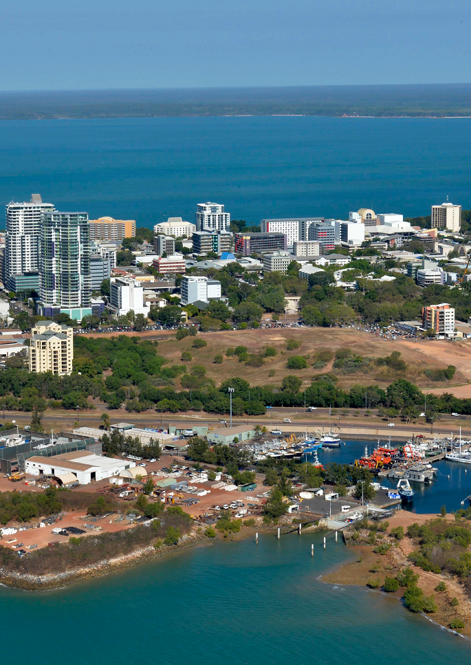
STATEMENT OF HERITAGE VALUE The Esplanade is a large area of public open space bordering the Darwin Central Business District and overlooking Darwin Harbour. Aboriginal sacred sites and a number of historical features and significant memorials are located across landscaped, open parkland fringed by remnant rainforest.
The Esplanade is a legacy of the original 1869 Palmerston (Darwin) town plan and echoes town planning principles imported from South Australia. It represents a colonial cultural treatment of the landscape through the provision of planned, public space. Maintaining public rights to this green space has been the focus of continual public advocacy.
Lands encompassed by The Esplanade are of cultural significance to Larrakia Aboriginal people because of the presence of the Damoe-ra sacred site which is represented by a freshwater spring created by the actions of a Dreaming ancestor, the doemgilla trevally fish. The Larrakia lived on Lameroo Beach and The Esplanade until the powers of the Aboriginals Act 1910 saw them relocated to the Kahlin Aboriginal Compound in 1912. This site is therefore associated with the increased marginalisation of Aboriginal people from the town at that time.
The Esplanade continues to have high aesthetic significance and is a landmark feature of the city. The monsoon rainforest along the escarpment made for a memorable entry for boats entering the harbour and reinforced the identity of the tropical, harbour town. The remnant rainforest is one of a small number of important rainforest patches on the Darwin Peninsular which act interdependently to maintain biodiversity.
While the extent of The Esplanade has changed over time, it has remained true to purpose for more than one hundred and fifty years. Its multi-layered history gives it a unique place in the social and cultural history of Darwin. The fresh water springs that sustained the Larrakia people were appropriated as the earliest water sources for the town. Fruit and vegetable gardens planted around the springs at Doctor’s Gully were taken over by Chinese people, who worked them for many decades. ‘Greek Town’ was established above the Gully. Popular swimming baths were developed at Lameroo Beach in 1921.
Between 1882 and the 1950s, the Darwin Oval was the centre for sporting activity in the town with the earliest cricket and Australian Rules football games played there. The Oval has been the destination point for military, May Day and Bougainvillea parades and has been the location for significant events like Royal visits. Across time The Esplanade has been a meeting and gathering place for cross-cultural encounters, picnics, celebrations, music and cultural festivals, protests and political agitation.
The Esplanade was occupied by the military during World War II and the anti-aircraft guns positioned there are claimed to be the first to fire at attacking Japanese aircraft on 19 February 1942. Further military infrastructure developed on The Esplanade include five Naval Oil Tanks and the RAAF Catalina base at Doctor’s Gully, remnants of which still exist. The relocation of the Cenotaph to The Esplanade in 1990, together with the USS Peary Memorial, the ANZAC Centenary Memorial Garden and Walk, and the Civilians Memorial Entrance has seen The Esplanade become the major site for official military commemorations and tourist visitation. They serve as poignant reminders of the sacrifices made during wartime and of Darwin’s important role in World War II.
Opposition to Heritage Listing
Recently the Lord Mayor of Darwin was on Katie Woolf radio, replay here: https://omny.fm/shows/360-with-katie-woolf/darwin-s-lord-mayor-kon-vatskalis-says-the-nt-gove#description railing against the proposed Heritage Declaration for the Esplanade Darwin. In an apparent rewrite of history, The Lord Mayor advised the listeners that the Council never had any intention to develop the Esplanade. This is despite the public record of the Council and elected officials spruiking the value of a RSL development on Esplanade land. An example is this article is the CEO recommending development on the Esplanade Oct 13 2020 https://ntindependent.com.au/council-acting-ceo-backs-contentious-move-to-provide-rsl-support/
I have previously asked the Executive and Councillors of the City of Darwin at the open session: Who does the Lord Mayor speak for when he is in the public arena? Do his words actually match the opinion of Corporate City of Darwin or the wishes of the elected Councillors or the constituents who vote the Councillors in?
In the Katie Woolfe article the Lord Mayor advises he has his lawyers working against this perfectly reasonable proposal to consider the Heritage value of our precious Esplanade.
For more recent history see this PLan article from November 2020 https://planinc.org.au/2-uncategorised/258-who-owns-darwin-esplanade.html
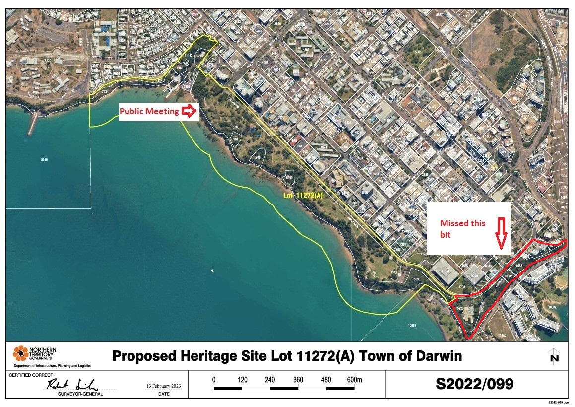
Part of The Esplanade has been missed.
We feel the whole of The Esplanade should be included in the declaration. If you agree that the integrity of the green escarpment and defined by the Esplanade should be preserved, please ensure that you note this in your submission.
Posted in Current Campaigns
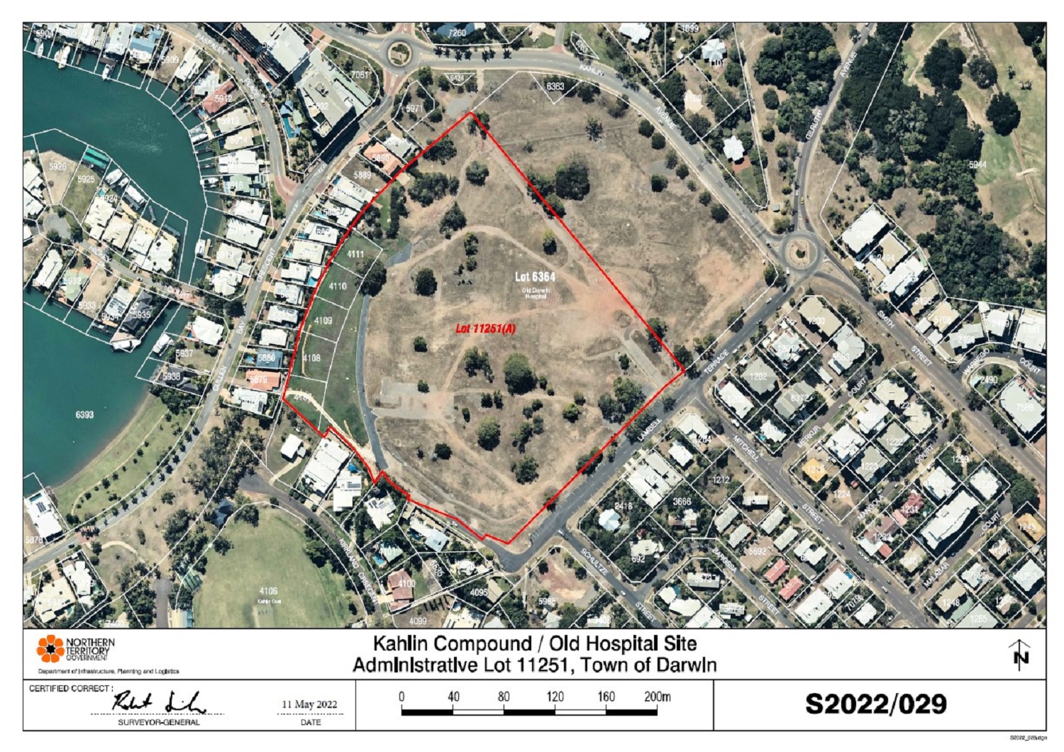
We are opposed to the adding of unnecessary conditions and inaccurate information to the proposal to heritage list the Kahlin Compound delaying the process.
PLan recommends that the whole of existing Lot 6364, Town of Darwin, covering the correct location of the Old Hospital Site Lot, remains un-subdivided, rejecting suggested new residential developments facing Kahlin Avenue, and the NT Heritage Triangle; and that the proposed red outlined 'Administrative Lot 11251, Town of Darwin Kahlin Compound/Old Hospital Site', be withdrawn, as the areas of the Kahlin Compound, and the site of the Old Hospital are not correctly geographically shown there.
You can sign the petition here: Petition: Heritage listing of Kahlin Compound with unnecessary conditions
Posted in Current Campaigns
RALLY - Public Meeting Thursday 9th February 5:30pm at Latrobe Park, all welcome.
In a Darwin wet season application, two poorly placed pink signs have appeared in Bayview. Residents have been given 2 weeks to comment on the rezoning to create an additional 21 lots mostly in the sub 500sqm size.
Now that there is no public advertising of Development Applications, community are required to access a government website to learn of this and similar applications.
The department has agreed to extend the exhibition process. BUT community are required to request the extension individually.
If you are concerned in this lack of equity, please send an email to:
This email address is being protected from spambots. You need JavaScript enabled to view it.
Request for extension for submission to PA2022/0474, Bayview
This application is my personal request for an extension of time for me to make a submission in relation to application PA2022/0474, Subdivision - Bayview, due at midnight 3/2/2023.
114142043_EJA_8093_-_Statement_of_Effect.pdf
114142045_8093-26_2022-09-29.pdf
114142047_8093-27_2022-09-29.pdf
114142049_8093-28_2022-09-29.pdf
114142051_8093-29_2022-09-29.pdf
114142053_8093-30_2022-09-29_zone.pdf
114142064_8093-32_2022-11-17.pdf
114142093_8093-31_2022-11-17.pdf
114142097_8093-33_2022-11-17.pdf
114142106_8093-34A_2022-11-16.pdf
114142110_8093-34B 2022-11-16.pdf
114142113_8093-34C 2022-11-16.pdf
114142119_Attachment A_Locality Plan.pdf
114142122_Attachment B_Lot Layout and Typical Section.pdf
114142123_Attachment_C_Master_Services_Plan.pdf
114142126_Attachment_D__Cadastral_Boundary_Plan.pdf
114142130_Attachment_E__Stormwater_Management_Plan.pdf
114142135_Attachment_F_Erosion_and_Sediment_Control_Plan.pdf
114142137_Attachment_G__Street_Lighting_Plan.pdf
114142156_Attachment_H__NBN_Plan.pdf
114142158_Attachment_I_Electrical_Reticulation_Plan.pdf
114142160_Attachment_J__DP_Geotechnical__Assessment_Lot_A_and_C.pdf
114142163_Attachment_K__Traffic_Impact_Assessment.pdf
114142165_Byrne_-_Site_Servicing_Report.pdf
Posted in Community Alert
Submission Writing Guide – URO application for a mineral exploration licence EL33285
Submissions due before 7 October 2022 by emailing This email address is being protected from spambots. You need JavaScript enabled to view it.

Summary
On 7 September 2022 URO Corporation Pty Ltd advertised in the NT News notification of their application for a minerals exploration licence covering 299km2 of land adjacent to Litchfield National Park (see above map). The application states that URO Corporation will explore for uranium, lithium, rare earth metals and precious metals. However the significant target of their exploration is uranium with drilling planned in year two of the exploration licence, if it is approved. We believe that the environmental, social, cultural, and recreational values of Litchfield National Park and the Litchfield-Finnis region are seriously threatened by this proposal and that the public should be fully informed about the potential impacts. We know that the residents of Darwin, Palmerston, Litchfield-Finniss and other areas of the Northern Territory and want to see Litchfield National Park and the Litchfield-Finniss region remain safe and healthy for the decades to come.
What is involved in URO Corporation’s application for mineral exploration licence EL33285?
The proponent of the exploration application EL33285 is URO Corporation Pty Ltd.
The mineral exploration licence EL33285 proposal involves the possible exploration of approximately 299km2 of land in the Litchfield-Finniss region adjacent to Litchfield National Park near Wangi Falls (see blue outlined area on map) over a period of six years, including clearing land and drilling for uranium. During exploratory drilling for uranium the environment and waterways could be exposed to toxic contaminants. Any contamination would need to be managed and possibly removed from the site which would include being transported through Litchfield National Park.
What are the problems with the project?
- Exploration for uranium can threaten human health
- The possible clearing of land for exploratory drilling will destroy wildlife habitat
- Tourism and local business can be negatively affected
- Cultural sites may be affected
- Possible contamination of land and waterways from Litchfield National Park to Channel Point through seasonal flooding
What should I include in my submission?
The most important thing to convey in your submission is your concern about possible negative impacts of the proposed exploratory licence and your interest in seeing the environmental, cultural, social, and recreational values of Litchfield National Park, the Litchfield-Finnis region and Channel Point protected. It is powerful to discuss the issues that are relevant to you through your recreational, professional, or cultural connection to the area. We need to demand transparency and accountability and ensure that the public are fully informed about the toxic activity planned for the Litchfield-Finnis region.
More points and wording for a submission can be found in the Protect the Litchfield-Finniss region from uranium & lithium mining petition on Change.org at https://chng.it/QWf92Tx5 and in the example submission letter on the following pages.
How do I make a submission?
Submissions are due to the Mineral Titles office before 7 October 2022 by emailing This email address is being protected from spambots. You need JavaScript enabled to view it.
Could you include the This email address is being protected from spambots. You need JavaScript enabled to view it. in your emailed submission?
Is there anyone I can ask for help about writing the submission?
Laura Cusack can answer questions you have about the submission. This email address is being protected from spambots. You need JavaScript enabled to view it.
Your Name
Address Line 1
Address Line 2
Date Month Year eg 26 September 2022
Mineral Titles
Department of Industry, Tourism and Trade
By email: This email address is being protected from spambots. You need JavaScript enabled to view it.
Dear Minister
URO Corporation Pty Ltd application for the grant of a mineral title EL33285
I am writing about URO Corporation’s application for the grant of a mineral title to explore for uranium and lithium on 299km of land in the Litchfield-Finniss region advertised on 7 September 2022 in the NT News.
[Write about who you are and how this proposal affects you] My partner and I are land owners of 20 acres of land in the proposed exploration area. We grow our own organic food and the creeks that flow through the area are our only water source for drinking and watering food crops, therefore we are directly affected by URO’s mineral title application, particularly if there is exploration for uranium and lithium by drilling.
I believe the licence should be rejected on the following grounds:
[List all points that are important to you. Additional points can be found in the petition at https://chng.it/QWf92Tx5]
- Mineral exploration, especially drilling for uranium which URO Corporation states will be their significant target, could negatively impact the environment and the creek and river systems in the area which are water sources for local flora and fauna as well as the only water source for residents who live in the area. The University of New South Wales’ Global Water Institute and the Environment Centre of the Northern Territory (ECNT) undertook a longitudinal assessment of the publicly available information on water related issues at Glencore’s McArthur River Mine over the period 2007 – 2018. The study analysis shows repeated failures on behalf of the mine site Operator and Mining Regulator to act in a timely manner to address risks to sensitive aquatic environments and has resulted in unacceptable risks to the Northern Territory environment and the downstream community of Borroloola. In 2014 the mine’s leaky tailings dam was found to be at risk of collapse and due to the leakage, high levels of lead were found in local fish stocks and 400 cattle had to be destroyed after the Department of Mines and Energy found cattle contaminated with lead after they drank from a contaminated creek (ECNT, date unknown). The water related issue at the McArthur River Mine is just one example of how the Northern Territory Government and mining companies are unable to respond adequately to protect water sources from contamination by uranium. The Rum Jungle tailing dam leakage and dam wall collapse, is another example where the Finniss river was contaminated with devastating results. We do not want to see this devastating environmental, water and business damage to occur again in the Litchfield-Finniss region.
- The proposed mineral exploration area is dangerously close to Litchfield Park’s Wangi and Cascade Falls, situated within the Litchfield National Park tourist precinct, which are Koongurrukun people’s cultural sites that require respecting and protecting by the Northern Territory Government.
- Litchfield National Park and the proposed exploration area have also been identified as home to 21 threatened species including the critically endangered Curlew Sandpiper, Eastern Curlew and Far Eastern Curlew as well as the endangered Australian Painted Snipe, Black-footed Tree-rat, Northern Quoll, and the Gouldian Finch. Allowing mineral exploration, especially for uranium, in the area will disturb and potentially destroy the habitat of these threatened species.
- There is also the prevalence of Gamba grass (Andropogon gayanus) in the proposed exploration area. Gamba grass is a highly invasive weed that is extremely harmful to the Northern Territory's natural environment. The grass seed is spread many ways including on the wheels of vehicles. Recent news reports have stated the large number of fires in the Litchfield and nearby Adelaide River areas over the recent months have been fueled by the prevalence of Gamba grass. There is grave concern that mineral exploration and mining in the proposed exploration area would create potential spread of Gamba grass through Litchfield National Park and other areas in the region via heavy vehicle movement between properties in the area, Aboriginal land, Litchfield National Park and sale destination.
- Landowners in the proposed area operate tourism and accommodation businesses as well as cattle stations that could be negatively impacted by the approval of the exploration licence for uranium and lithium, in particular. Landowners and residents also grow their own food crops. URO Corporation and any company granted a mining exploration licence in the Northern Territory is under no obligation to assess any possible impact or substantial disturbance to landowners and residents’ income, livestock, business, assets or ability to grow food on the land which may have taken many years and significant investment to establish.
- The proposed exploration area borders Litchfield National Park on one side and the Aboriginal lands of the Wadjigan and Kiuk people, and the Channel Point Coastal Reserve on the other. The Channel Point region is home to the Peron Island, Bulgul community and Channel Point community. The area, including the Peron Islands, is a protected coastal habitat that is an identified area of international conservation significance and home to threatened and significant fauna. The area is also an important tourism area via a permit system as well as facilitating numerous fishing charters. The proposed exploration area is home to a network of river systems that are a part of the Daly Basin, including the Anton Bay and associated coastal floodplains which connect with the mouth of the Daly River and flows into Wadjigan and Kiuk lands and the Channel Point area. Any contamination from wastewater overflow in the proposed exploration area could spill into these interconnected river systems via floodplains in the wet season and have a potentially devastating effect on a pristine environment in the Channel Point area, one of the most fertile fishing grounds in the Northern Territory.
- With local waterways so interconnected and multiple biodiverse areas, protected habitat, flora and fauna connected to these waterways as well as these waterways providing the only accessible drinking and crop water in the area, this is a situational context that should be seriously considered in assessing this mineral exploration application.
- We are very concerned by the prospect of increased heavy vehicle movements between properties in the area, Aboriginal land, Litchfield National Park and sale destination due to the damage these vehicles can cause.
- We are extremely concerned about the methods involved in uranium and lithium exploration and mining and their environmental impacts. We understand that the methods used can be extremely damaging to the environment, water intensive with billions of litres of contaminated water to dispose of and involve a form of strip mining for pegmatite which occurs throughout the region, as well as blasting, crushing and processing using toxic chemicals. We need look no further than the legacy of the Rum Jungle mine in the Litchfield/Batchelor area for evidence of the damage of government approved uranium mining. Following the collapse of the mine’s tailing’s dam, 100 km2 of the Finniss River system was polluted killing all plant and animal life for a 10 kilometre stretch of the river (Senate Select Committee on Uranium Mining and Milling, 1997). To this day, 50 years since it closed, the Rum Jungle mine site continues to leave a legacy of environmental damage so severe that it will cost hundreds of millions of tax payers’ dollars to rehabilitate the site over decades (ABC News, 2021). The Northern Territory Government has an obligation to never allow this gross environmental destruction to occur again in the region.
- The Senate Select Committee on Uranium Mining and Milling report published by the Australian Government in 1997 found that uranium mines, including Rum Jungle, cause serious environmental damage through acid mine drainage in terms of tailings waste, production and mining processes. Tailings from uranium mining contain 80% of the level of radioactivity of the original ore as a result of the presence of uranium decay products such as Thorium 230, Thorium 234 and Radium 226. The environmental impacts of tailings have been well documented for uranium mines including the Roxby Downs and Ranger uranium mines, as well as Radium Hill and Rum Jungle. (Senate Select Committee, 1997).
- We have no faith that the Department of Industry, Trade and Tourism (the Department) will appropriately monitor and regulate the activities of URO Corporation. Section 66 (2) under the Mineral Titles Act states that “no later than 14 days after lodging an application for the grant of a mineral title, the applicant must serve a notice of the making of the application on each landowner listed in the application.” In the case of EL33285, URO Corporation did not serve notice to landowners in the area within this timeframe. Notices were served by URO Corporation to landowners nine months after the application was submitted, two weeks before URO Corporation advertised the application for the granting of a mineral exploration licence. Notifying landowners so late after the application was submitted left landowners in the area very little time to prepare submissions which are due, under the Mineral Titles Act, within 30 days of the application being advertised. Landowners and other stakeholders in the area have been severely disadvantaged by this action undertaken by URO Corporation. When the Mineral Titles Office (the Office) were contacted by phone about the notification timeframe they stated that they have no way of knowing if applicants have actually served notifications to landholders within the requirement of the Mineral Titles Act. It appears the Office does not have appropriate processes in place to ensure applicants are following the required regulations. This becomes increasingly important given that under section 58 (2)(b) of the Mineral Titles Act “the applicant must have complied with requirements under this Act” and under section 70 (2) “If the Minister is satisfied the applicant has not met the necessary criteria for the application, the Minister may refuse the application.”
Yours sincerely
Name
Address line 1
Address line 2
Posted in Community Alert
Volunteer Required - Project Officer – Part time - reside in Australia
Overview
PLan: the Planning Action Network Incorporated Inc collaborates with resident and community groups on matters including the built environment, heritage, cultural and environmental values of concern in the Northern Territory and Australia. PLan’s aim is to achieve, for the community, sustainability in terms of social, cultural, environmental and balanced long term economic impacts.
Applicants would benefit from, but not necessarily require experience in:
Project management, document preparation and campaign management, town planiing studies
Attributes that would assist in you carrying out your duties:
A desire to influence change in the positive, a strong sense of place, capacity to enable community and an understanding of the history of the Territory’s built environment.
This position is unpaid and arrangements are by negotiation. A commitment to a minimum number of hours per week would be required.
Our office is located at Raffles, 8/1 Buffalo Court Darwin NT 0800.
For more information, please email at This email address is being protected from spambots. You need JavaScript enabled to view it. or call 0447 499 794
Under the guidance of the Convener the volunteer will:
- Perform scans for information relevant to the organisations goals
- Collate materials and prepare reports on gathered information
- Prepare and enter materials into the online archive
- Update internet facing assets
The volunteer will have the opportunity to participate in community and other meetings.
For more information, please email at This email address is being protected from spambots. You need JavaScript enabled to view it. or call 0447 499 794
www.planinc.org.au
Posted in Current Campaigns
Closing October 2022 this consulation
to quote:
The Department of Infrastructure, Planning and Logistics (DIPL) is seeking environmental approval for a ‘development ready’ industrial precinct on the Middle Arm peninsula. If approved, it may include low emission hydrocarbons, renewable hydrogen, minerals processing, carbon capture and storage and advanced manufacturing. The precinct would cover approximately 1500 hectares of the 2200-hectare Middle Arm peninsula, in an area designated for gas-based, low emissions sustainable industries. Middle Arm is already home to the Santos Darwin LNG Project at Wickham Point, and the INPEX LNG Project at Bladin Point.
Strategic assessments should provide greater upfront certainty for developers while also delivering better environmental outcomes for the significant environmental values at Middle Arm and the broader Darwin Harbour.
The MASDP referral is the first ‘strategic assessment’ in the Northern Territory.
The NT EPA invites public comment on a proposed Program to establish an industrial precinct on Middle Arm Peninsula, Darwin Harbour, here ntepa.nt.gov.au/consultation/open-consultations (this is another useless link)
The survey is here: https://haveyoursay.nt.gov.au/middle-arm-sustainable-development-precinct/survey_tools/survey
Middle Arm-environmental-assessment-fact-sheet-april-2022.pdf
Middle Arm_Community_Factsheet_Aug_2022_08_web.pdf
Posted in Community Alert
Make a submission
You can make a submission by emailing This email address is being protected from spambots. You need JavaScript enabled to view it.
You must sign your uploaded submission to ensure that it is valid under the Planning Act. A valid signed submission includes a hand-signed document that is scanned and/or photographed; a name typed at the bottom of an email or uploaded document; or a JPG (or similar) of a signature placed at the bottom of the email or uploaded document.
Contact your Local Member, the three City of Darwin Alderman and the Planning Minister. Should community be involved in planning decisions?/
Exhibition Period: Friday, 9 September 2022 - Midnight Friday, 7 October 2022
Address:
Lot 01287 Town of Darwin 1 MONTORO CT LARRAKEYAH
Lot 01288 Town of Darwin 2 MONTORO CT LARRAKEYAH
Lot 01295 Town of Darwin 8 PACKARD PL LARRAKEYAH
Lot 01296 Town of Darwin 7 PACKARD PL LARRAKEYAH
Current Zones: TC (Tourist Commercial)
Proposed Development:
44 dwellings-multiple and 47 serviced apartments in two 10-storey buildings plus ground level food premises-cafe/takeaway with alfresco dining area and three basement levels of car parking.
Requested Variations: Setbacks
Read this first: Report.pdf
Attachment_A_-_Architectural_Plans.pdf
Attachment_B_-_DP15-0400_NOC.pdf
Attachment_B_-_DP15-0400_ED.pdf
Attachment_B_-_DP15-0400.pdf
Attachment_C_-_DP14-0362_ED.pdf
Attachment_C_-_DP14-0362_NOC.pdf
Attachment_C_-_DP14-0362.pdf
Attachment_D_-_Title_-_1296.pdf
Attachment_D_-_DP13-0895.pdf
Attachment_D_-_Titles_-_1287__1288_and_1295.pdf
Scroll down for our comments.
- Generally, some of the surrounding buildings are 8 story, these proposed buildings are not cohesive with existing buildings.
- The owners of this site have carried out remedial works with almost no consultation with community, including works commencing with no builder identified.
- Multiple complaints have been placed with work safe due to gates being left open and the site not being kept secure. For many years there has been water in the pit.
- Works are carried out with no safety signage.
- The site was originally low height. Community has an expectation of existing views being retained.
- This project is impact assessable.
- The location is close to MD and SD
- The applicant refers to planning history then recognizes that planning history cannot be used in this application
- All traffic will be directed through Montoro Court and Packard Place with no consultation with the community
- There is a large void in the project and the proponent has a track record of trying to maximise the footprint
- The proponent claims to minimize impact on the local area. P13
- The applicant describes the building heights as compatible with adjacent locations yet on at least two sides the towers will dominate.
- The applicant claims Smith street will not be affected while introducing hundreds of cars through the considerably congested Smith Street intersections. P17 the claim is here of high amenity to the public realm. What is the basis of this statement?
- The café claims to service tourism.
- Many serviced apartments in Darwin have been returned to the residential pool.
- P18 the claim is here that the development minimizes unreasonable impacts to the amenity of surrounding premises. What proof is given.
- P18 the applicant refers to multiple 9 story buildings adjacent, clearly not true? P18
- The claim that the building will be a positive character addition to the area is opinion only. P19
- The disadvantage of having our homes overlooked by these units is not addressed.
- The applicant claims to minimize any unreasonable amenity impacts, on what basis? Has community been consulted? P19
- The claim that previous traffic studies and that traffic has not changed since 2015 does not bear scrutiny. There appears to be only the applicant’s assertion that all is ok on traffic.
- There is no garden to Montoro Court.
- Three bedroom serviced apartments only require one car park. This is a planning error, see Tipperary.
- P 23 mention of vehicle sites lines not being an issue, where is the traffic study?
- No tree planting on Montoro Court
- What guarantees are provided that landscaping will be maintained for the life of the building. Refer to very poor condition of the location for many years.
- Smith Street setback is non compliant and the applicant again refers to a previous approval which is irrelevant. This will lead to massing over Smith Street. The purpose of the Smith Street setback was to provide continuous views and recent planning approvals are degrading this feature, diminishing the amenity of the area. P32
- Set backs are dealt with as if two buildings yet the buildings are connected.
- Set back to Montoro Court does not comply
- Set backs to the rear of the building do not comply.
- Again many setbacks do not comply at all. Why have a planning scheme?
- The proponent then brings in NTCAT. The community has an expectation that planning legislation will protect the community from opportunism.
- Again, reliance on previous approvals which are irrelevant.
- The application takes advantage of being two buildings in one argument (set backs) then as one building from the point of view of distance between the building, this value is not discussed. P40
- 18 units have a reduce verandah size. The applicant proposes there is no need to following planning regulations here as not many people will be in the one bedroom units.
- P 45 no addressing the requirement to minimize unreasonable impacts on the privacy and amenity of surrounding residents.
Posted in Community Alert
The Old Asti Motel site is again before the Development Consent Authority
We need your support in our campaign for a decent community outcome with this contentious development.
On this web page you can make a donation, sign up for our newsletter, read the submission and find our what is happening in the campaign.
| Donations |
|
|
|
|
ASTI Motel Site
ASTI Motel Site - Public Meeting 5:00pm
Wednesday 11th October at Plan office 8/1 Buffalo Court
A zoom link will be avaialble contact This email address is being protected from spambots. You need JavaScript enabled to view it.
|
| Newsletter |
|

Sign up for Newsletter
|
|
Contact
|
|
For more information:
Nick Kirlew
Convener PLan: the Planning Action Network Inc
0447 499 794
Email: This email address is being protected from spambots. You need JavaScript enabled to view it.
Web: https://www.planinc.org.au
|
Download the flyer here: Flyer6.pdf
Contact your Local Member, the three City of Darwin Alderman and the Planning Minister. Should community be involved in planning decisions?
Councillor Amye Un This email address is being protected from spambots. You need JavaScript enabled to view it. 0499 382 948
Councillor Mick Palmer This email address is being protected from spambots. You need JavaScript enabled to view it. 0418 892 943
Councillor Sam Weston 0416 784 968
Hon Paul Kirby This email address is being protected from spambots. You need JavaScript enabled to view it. (08) 8999 6755
Below we have comments on the proposal, scroll down or click here.
Make a submission
You can make a submission by emailing This email address is being protected from spambots. You need JavaScript enabled to view it.
You must sign your uploaded submission to ensure that it is valid under the Planning Act. A valid signed submission includes a hand-signed document that is scanned and/or photographed; a name typed at the bottom of an email or uploaded document; or a JPG (or similar) of a signature placed at the bottom of the email or uploaded document.
Exhibition Period: Friday, 8 September 2023 - Midnight Friday, 13 October 2023
Address:
Lot 01287 Town of Darwin 1 MONTORO CT LARRAKEYAH
Lot 01288 Town of Darwin 2 MONTORO CT LARRAKEYAH
Lot 01295 Town of Darwin 8 PACKARD PL LARRAKEYAH
Lot 01296 Town of Darwin 7 PACKARD PL LARRAKEYAH
Current Zones: TC (Tourist Commercial)
Proposed Development: Readvertised with changes: 56 dwellings-multiple and 63 serviced apartments in 1x10 and 1x11 storey buildings plus three levels of basement car parking.
NOTE: there have been changes to the documents exhibited during the exhibition period. At this time PLan believe this is the correct list. More information as it comes to hand. 3/10/23 - DAS advise the website is now in good order the zip download matches the web site list.
This is the set released on 23/9/2023
Re: PA2022/0321 Amended Proposal - CRTPC20-22_Letter_2.pdf
Statement of Effect - 21/08/2023 Version 2.1 Amended_statement_of_effect_PA2022-0321.pdf
Attachment A Architectural Plans 113510959_Attachment_A_-_Architectural_Plans.pdf
Amended development plans Amended_development_plans_PA2022-0321.pdf
Attachment E - Traffic Review dated 15/8/2023, review done in 2019 with a no change seen clause amemnded Attachment_E_-_Traffic_Review.pdf
Attachment F - Title - 1296 - Attachment_F_-_Title_-_1296.pdf
Attachment F - Titles - 1287_ 1288 and 1295 - Attachment_F_-_Titles_-_1287__1288_and_1295.pdf
Below here the documents are all 8 years old and should have no bearing on the current proposal. These documents are included in the proposal by the proponent.
Attachment B - DP15-0400 ED - these drawings are dated 27/04/2015 - Attachment_B_-_DP15-0400_ED.pdf
Attachment B - DP15-0400 NOC - this document is from 2015 and refers to an aged development permit - Attachment_B_-_DP15-0400_NOC.pdf
Attachment B - DP15-0400 - Development permit DP15/0400 dated 14/7/2015, permits lapse in 2 years - Attachment_B_-_DP15-0400.pdf
Attachment C - DP14-0362 ED - These drawings from 2015 - Attachment_C_-_DP14-0362_ED.pdf
Attachment C - DP14-0362 NOC - Notice of Determination PA2014/0218 this is dated 2014 - Attachment_C_-_DP14-0362_NOC.pdf
Attachment C - DP14-0362 - Development permit DP14/0362 dated 3/7/2014, permits lapse in two years Attachment_C_-_DP14-0362.pdf
Attachment D - DP13-0895 - Development permit DP13/0895 dated 23/2/2013, permits lapse in two years
There has been no attempt by the proponent to engage with community members to understand their concerns and gauge input to what is a contentious proposal.
The traffic review was carried out in 2019 and advises there has been no change in traffic conditions since that time. The time frame was during Covid, also there was no City Deal CDU campus or any Neuron scooters.
Development permits and drawings from 2013, 2014 and 2015 are attached creating confusion.
All traffic will be directed through Montoro Court and Packard Place with no consultation with the residents of those streets.
There is no setback from the Smith Street facing building, the land is public land, and the development should adhere to good planning. The interconnected network calls for an enhanced streetscape and landscape yet the building will be out of character with the other buildings facing Smith Street by adjoining the street reserve.
The proponent shows buildings on the other side of Smith Street as having no setback. This side of Smith Street has managed to preserve the road reserve and building setback from the road reserve throughout the development of the street. This would be a poor precedent and affect the site lines. To claim the reduced setback would be in character with Smith Street as it stands today is disingenuous. The claim that by allowing a reduced setback has generated an increased setback on other boundaries (above legal requirements) is irrelevant. It is assumed that planning regulations provide for appropriate building envelopes.
The tallest building nearby is 9 storeys, most of the buildings surrounding are 4 storey or less. Buildings of a height of 11 storeys are a significant outlier.
Serviced apartments have a lesser floor space requirement allowing for higher density, these apartments have been sold into the investment and residential stock across Darwin over the years.
The act calls for Limited residential, commercial and community uses, such as dwellings-multiple, childcare centre and community centre, where the nature of the activity does not compromise the primary use of the locality for tourist commercial activities. This development is 47% declared residential and it can be expected the 53% Serviced Apartments will certainly mimic the residential uses of the site. The claim that the serviced apartments will be tourist use does not take into account the known student accommodation short fall in Darwin.
Planning Scheme - Tourist Commercial (in part, see nt-planning-scheme-part-4-zones-and-assessment-tables.pdf). https://nt.gov.au/property/land-planning-and-development/our-planning-system/nt-planning-scheme
Zone Purpose
Facilitate commercial and residential development that caters for the needs of visitors, supports tourism activities, and is of a scale and character compatible with surrounding development.
The design, operation and layout of development:
(a) makes a positive contribution to the locality by incorporating a high quality of built form and landscape design;
(b) minimises unreasonable impacts to the amenity of surrounding premises;
(c) mitigates the potential for land use conflict with existing and intended surrounding development;
(d) avoids adverse impacts on the local road network;
This development is only residential, there is no retail/commercial/community facilities/urban open space.
The proponent claims to contribute to the amenity of the public realm with buildings that are clearly out of touch with the existing built form of the area.
The proponent claims to accommodate a range of demographic groups but offers no explanation of how this will be achieved.
The proponent claims a quality of landscaping without out any documentation as to the method of defining the quality. The drawings show street trees which do not exist and there has been no effort by any entity to promote the greening of the area. The proponent has shown no interest in the look and care of the site in the decades we have waited for an appropriate outcome.
Further the fact that the apartments will have sea views is purported to contribute to:
Amenity, in relation to a locality or building, means any quality, condition or factor that makes or contributes to making the locality or building harmonious, pleasant or enjoyable.
In fact, the buildings will decrease the amenity of those existing buildings with views as well as drastically change the nature of the two cul-de-sac streets.
The proponent claims that that the development is reasonably predictable. The term reasonably predicable is non sensical. It is reasonably predicable that it will rain before Christmas, what relevance is that to the planning legislation?
This ignores that the community had a two-story motel with restaurant on the site for many years. The expectation of a like for like development would be reasonable.
There is no mention of tree planting to the Montoro Court to ensure an attractive site presentation.
The proponent calls for reduced balcony size on the one-bedroom apartments. This should not be permitted as it will create precedent. It is reasonable to expect that two people will live in the one-bedroom apartments and thus the legal requirement for private space should not be reduced.
Building articulation is not used on the internal facing walls. These walls will be visible from adjoining properties and street traffic.
Please copy your comments to PLan on This email address is being protected from spambots. You need JavaScript enabled to view it.
This is the set loaded originally on 8 September 2023
Read this first: 116132230_CRTPC20-22_Report_2.pdf
Intro letter: 116132228_CRTPC20-22_Letter_2.pdf
Architectural Plans: 116132233_Attachment_A_-_Architectural_Plans.pdf
116132236_Attachment_B_-_DP15-0400_ED.pdf
116132239_Attachment_B_-_DP15-0400_NOC.pdf
116132242_Attachment_B_-_DP15-0400.pdf
116132245_Attachment_C_-_DP14-0362_NOC.pdf
116132248_Attachment_C_-_DP14-0362_ED.pdf
116132251_Attachment_C_-_DP14-0362.pdf
116132254_Attachment_D_-_DP13-0895.pdf
116132257_Attachment_E_-_Traffic_Review.pdf
116132260_Attachment_F_-_Title_-_1296.pdf
116132263_Attachment_F_-_Titles_-_1287__1288_and_1295.pdf
116216758_Amended_statement_of_effect_PA2022-0321.pdf
116216760_Amended_development_plans_PA2022-0321.pdf
Posted in Current Campaigns
The PLan AGM is to be held Saturday 17th September 4:45 for a 5pm start at Flagstaff Park.
Here are the papers:
AGM-Request for items of Business.pdf
AGM-Nomination Form.pdf
AGM-Proxy Form.pdf
Provisional Agenda for AGM Meeting.pdf
Attendance.pdf
Conveners Annual Report for 2021.pdf
Posted in Current Campaigns
Hello Everyone,
This is closing on the 15th of April 2022. Please return to this page as we will be updating over the next few days.
PROPOSAL TO AMEND NT PLANNING SCHEME PA2022/0011 PROPOSAL TO AMEND THE NT PLANNING SCHEME 2020 TO INCLUDE THE HOLTZE TO ELIZABETH RIVER SUBREGIONAL LAND USE PLAN AS A POLICY DOCUMENT AND CONSEQUENTIAL UPDATES TO THE LITCHFIELD SUBREGIONAL LAND USE PLAN AND DARWIN REGIONAL LAND USE PLAN.

You can download the document here: 112379353_Explanatory_Documents_Optimized.pdf
We have reviewed the documents provided as part of the proposed amendment and have provided the following summary of our concerns:
- Areas such as the natural catchments, which are prone to constraints such as flooding, should exclude any residential development in these areas. It would be unnecessary for residential development to occur, only for this community to be subjected to damage and/or destruction as a result of known area flooding.
- We are concerned that in the absence of a Regional Conservation Strategy, development will occur which will impact upon natural environments and areas of environmental value.
- We support the identification of paperback swamp, east Tiger Brennan Drive/ Tivendale Road as a conservation area and believe this status should remain unchanged.
- We are concerned of mention that “…property along the Stuart Highway will become increasingly attractive for commercial uses…” (p. 22) and as a result, will have potential impact upon current green space.
- We are concerned that the Howard Springs North Investigation area, south of the Main Road and part of the Howard Springs North (Pine Forest), will ultimately encroach and impact upon the Howard Springs Nature Park.
- We are concerned that “…the (former) Commonwealth Defence establishment land ‘Kowandi North’ (Kowandi), and conterminous Crown land to the north and east creates the potential for approximately 5000 dwellings to be developed in the near to mid-term through staged land releases” (p. 24). As a result, this will impact upon the ‘open space’ and/or ‘conservation’ site area.
- We support mention that “any future land use change across the Howard Springs North area should consider the potential of retained natural areas to support both organised and passive recreation” (p. 26). The Northern Territory should retain as much natural area for community benefit and use and should not be subject to development.
- We are concerned of mention that “…a large part of Virginia South-West is constrained by either soil waterlogging, storm surge, or exposure to biting insects” (p. 28). Given that the area is prone to storm surge, future development of the area would be inappropriate. It would be unnecessary for residential development to occur, only for the community to be subjected to damage and/or destruction as a result of known storm surge issues.
- Previously the accepted distance was 1.5km for biting insects. Nick Note
- We are concerned about mention of future development in the Archer and Mitchell West Focus Area. As the proposed planning scheme amendment document mentions, “(b)oth areas are affected by seasonal waterlogging and storm surge” (p. 30). As mentioned previously, given that the area is prone to storm surge, future development of the area would be inappropriate. It would be unnecessary for development to occur, only for the community to be subjected to damage and/or destruction as a result of known storm surge issues.
Posted in Community Alert
On the NT Gov Planning site there is a proposal to carve up the Malak Caravan site.
Submissions close Midnight Friday, 15 April 2022. https://www.ntlis.nt.gov.au/planning-notices-online/notices#/
On this page we have the Rezoning and the Current Proposal.
OUR THOUGHTS ON THE CURRENT PROPOSAL ARE:
- Why has no referral to the EPA occurred given the proximity to Rapid Creek.
- A significant change from grassed open space to solid foundations will occur if this development is approved.
- How many community members submitted on the rezoning?
- Will the Sound Barrier wall to McMillans Road be maintained in good order? Lee Point and other locations show that there is no guarantee of upkeep of these walls.
- The small blocks are 400sqm and if all blocks are developed to capacity the maximum number of dwellings able to be accommodated in the proposed subdivision is 98 dwellings
- Battern Road - At this stage, the future connection to Batten Road is not resolved, and will be done so as part of a future application for stage 2 of the subdivision.
- The applicant seeks variation to building envelopes on a number of lots. On a green fields build we consider that this should not be required.
This is the current proposal
112247842_CRTPC13-22 Report.pdf
112247844_ATTACHMENT_A_-_Development_Plan.pdf
112247846_ATTACHMENT_A_-_Subdivision_Master_Plan.pdf
112247849_ATTACHMENT_B_-_Landscaping_Master_Plan.pdf
112247854_ATTACHMENT_C_-_Servicing_and_Construction_Report.pdf
112247851_ATTACHMENT_D_-_Acoustic_Assessment.pdf
112247856_ATTACHMENT_E_-_Certifier_Statement.pdf
112247858_ATTACHMENT_F_-_Title_1841.pdf
112247860_ATTACHMENT_F_-_Title_1842.pdf
112247862_ATTACHMENT_F_-_Title_1843.pdf
The Rezoning was carried out last year
Two documents found on-line regarding the proposed subdivision.
The first indicates the proposed amendment from a zone CV to zone LMR had an exhibition period from 16 April 2021 to 14 May 2021.
The second indicates that the planning scheme was then amended in mid-September, 2021, allowing for a change from zone CV to zone LMR.
To quote the Minister: ... the proposed rezoning would be unlikely to compromise or impact the
land, its ecological processes or the quality of life for future generations; ...
Posted in Community Alert
DAY/DATE: Thursday 17th February 2022
TIME: 4:30pm – 6:30pm
LOCATION: Raffles Plaza, Suite 8 / Level 1, 1 Buffalo Court, DARWIN NT 0800
RSVP: This email address is being protected from spambots. You need JavaScript enabled to view it.
This PLan workshop is to secure Flagstaff Park in future, for all. On 5 February 2003, Clare Martin as Chief Minister, by Government Media Release, declared Flagstaff Park, at the end of Myilly Point, to be 'handed back to the people as a public park’, and not built on. Instead, it 'would be preserved for future generations, for the use and enjoyment of all Territorians.
Posted in Community Alert
Here is our first newsletter for 2022.
Introduction
A busy time with PLan being successful in a small grant to encourage volunteers. So if you have some free time we can provide transport to bring you into the office and return you home.
The application to create 7 house blocks on Rapid Creek Road each less than 300sqm is very concerning. Meanwhile a double barrelled amendment to the Planning Act is coming through with some novel ideas on cutting community out of the process.
A year later Bagot Park and the Velodrome are back on the agenda.
While Little Mindil is back with the developer we need to keep the awareness going. We have more flyers ready for distribution.
We are holding a workshop on Flagstaff Park see below for more details.
We have t-shirts, calendars and now the Living with Migratory Shorebirds at Lee Point book is available for purchase. To read the book online go here: Migratory Shorebirds at Lee Point
Memberships are open and any donations gratefully received here: Memberships and Donations
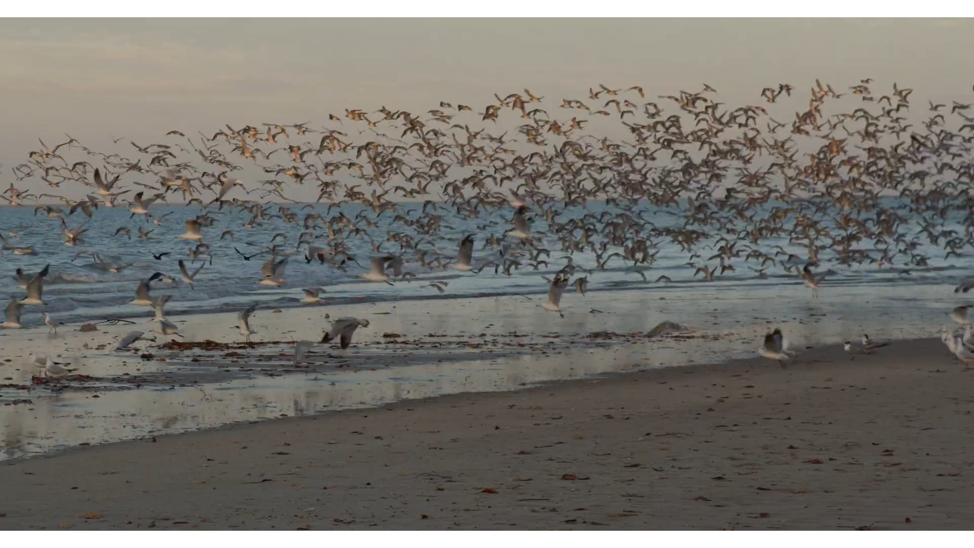
Rapid Creek Road - Thin Edge of the Wedge
Closing 18th February 2022
This is a very concerning application that will change the amenity of Rapid Creek Road and create an unacceptable precedent in the northern suburbs.
Tropics Consultancy Group has applied to the Minister for Infrastructure, Planning and Logistics for an Exceptional Development Permit (EDP) for the purpose of a subdivision and consolidation to create 11 lots (with 7 lots less than 300m2) and a building envelope plan on Lots 1257, 1258 and 1259 (1 Brooks Place, 37 Rapid Creek Road and 14 Aldridge Place, Milner) Town of Nightcliff.
Join us at the Public Meeting: 5:30 Monday 14th February opposite 37 Rapid Creek Road.
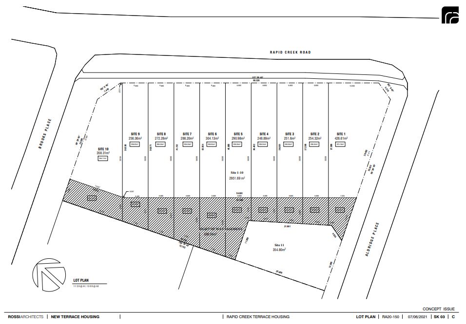
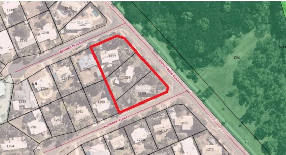
You don’t need a development permit for a permitted use
From the desk of Planning Reform Team, Department of Infrastructure, Planning and Logistics
This closes Midnight Friday, 4 March 2022
The attachments are on the Plan website here: Permit not required
Here is an extract which appears to be concerning:
Establishing a Permitted Use Department of Infrastructure, Planning and Logistics Page 1 of 3
A permitted use under the NT Planning Scheme 2020 may not require a development permit.
However, if property is within a building control area, building certification may be required.
You don’t need a development permit for a permitted use if the development:
- meets all planning requirements, and
- does not require consent because of an overlay
Playford Street Tree Clearing
This extract from an article by a local resident:
In 2014 the former Lord Mayor and officials visited my home after some large trees were cut down by the COD under the excuse of “tree roots create mosquito breeding sites in the drain/creek”, so the trees have to go. The former Lord Mayor said future trees and native grass would be encouraged to grow in the area and trees won’t be felled again.
However, on 7 December 2021, COD contractors turn up and start chain-sawing down trees in the creek/drain area and using a crane to lift them out. The COD advised this was to remove coffee bush – but no coffee bush was being cut – just trees, on the banks, floor and tops of the drain / creek.
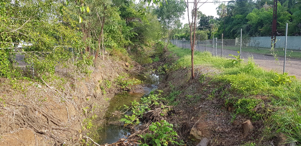
Read the full story here: Playford Street Tree Clearing
Lee Point Art Competition - opens soon
The Lee Point Art Competition is free and open to anyone 18 years or younger in the Territory. The artwork needs to be visual and can be: painting, drawing, prints, photo, sculpture or short video. The artworks will be judged on their idea, uniqueness and art characteristics.
The prize pool is $1,500 and growing!
Read the full story here: https://saveleepoint.org.au/lee-point-art-competition
PLan events coming up:
Saving Flagstaff Park- Urgent Alert!!!
SUBJECT: Flagstaff Park Submission Writing Workshop
DAY/DATE: Thursday 17th February 2022
TIME: 4:30pm – 6:30pm
LOCATION: Raffles Plaza
Suite 8 / Level 1
1 Buffalo Court
DARWIN NT 0800
RSVP: This email address is being protected from spambots. You need JavaScript enabled to view it.
MISC: Stationery, drinks and nibbles supplied
DESCRIPTION: This PLan workshop is to secure Flagstaff Park in future, for all.
On 5 February 2003, Clare Martin as Chief Minister, by Government Media Release, declared Flagstaff Park,
at the end of Myilly Point, to be 'handed back to the people as a public park’, and not built on.
Instead, it 'would be preserved for future generations, for the use and enjoyment of all Territorians.’
Flagstaff Park (Lot 5180) was then rezoned to PS (Public Space) for 'the use and enjoyment of all Territorians.'
'This Government', she said, ‘believes the character of Darwin as a city should be built around a balance of open space and development.’
But in 2020 came a proposal for change to the rezoning of Flagstaff Park.
Please join us for the workshop.
More information about Flagstaff Park at: https://planinc.org.au/news/current-campaigns-3/138-flagstaff-park-history.html
- Next Committee meetingis Thursday 3rd March
- Next AGMis Saturday 23rd April 2022 5:30pm venue to be advised
Bagot Park
Advice is that the long-awaited community engagement plan will be going public on February 14th with on-line workshops and surveys.
Read more here: Bagot Park Update
Regards
Nick Kirlew, Convener, PLan: The Planning Action Network,
Mobile: 0447 499 794
Email: This email address is being protected from spambots. You need JavaScript enabled to view it.
Posted in Blog & Opinion
Closing 18th February 2022 - Public Meeting 5:30 Monday 14th February opposite 37 Rapid Creek Road
This is a very concerning application that will change the amenity of Rapid Creek Road and create an unacceptable precedent in the northern suburbs.
Tropics Consultancy Group has applied to the Minister for Infrastructure, Planning and Logistics for an Exceptional Development Permit (EDP) for the purpose of a subdivision and consolidation to create 11 lots (with 7 lots less than 300m2) and a building envelope plan on Lots 1257, 1258 and 1259 (1 Brooks Place, 37 Rapid Creek Road and 14 Aldridge Place, Milner) Town of Nightcliff.
110853514_21085_-_The_Terraces_CIVIL_and_ENG_TCG.pdf
110853569_The_Terraces_Proposed_Statutory_Covenant_TCG.pdf
110853572_The_Terraces_Design_Guidelines_TCG.pdf
110853598_RA20-150_-_The_Terraces_-_EDP_Plans_TCG.pdf
110889468_TCG_Lot_1257__1258_and_1259_EPD.pdf
Posted in Community Alert
Sue of Fannie Bay asks who made the decision to close the Parap Pool for maintenance in the middle of the school holidays and the hottest time of the year?
The answer is the City of Darwin (COD) and as a resident next to the Playford street Racecourse Creek / Drain I can report on my totally unsatisfactory recent experiences with the City of Darwin.
There is a perfectly functioning creek (now classified as a drain by the COD) that runs between Playford Street and the Darwin Turf Club. It provides a habitat for frogs, birds and wildlife. It has not been maintained by the COD for many years and during that time it has effectively managed stormwater dispersal, including during Cyclone Marcus.
In 2014 the former Lord Mayor and officials visited my home after some large trees were cut down by the COD under the excuse of “tree roots create mosquito breeding sites in the drain/creek”, so the trees have to go. The former Lord Mayor said future trees and native grass would be encouraged to grow in the area and trees won’t be felled again.
However, on 7 December 2021, COD contractors turn up and start chain-sawing down trees in the creek/drain area and using a crane to lift them out. The COD advised this was to remove coffee bush – but no coffee bush was being cut – just trees, on the banks, floor and tops of the drain / creek.
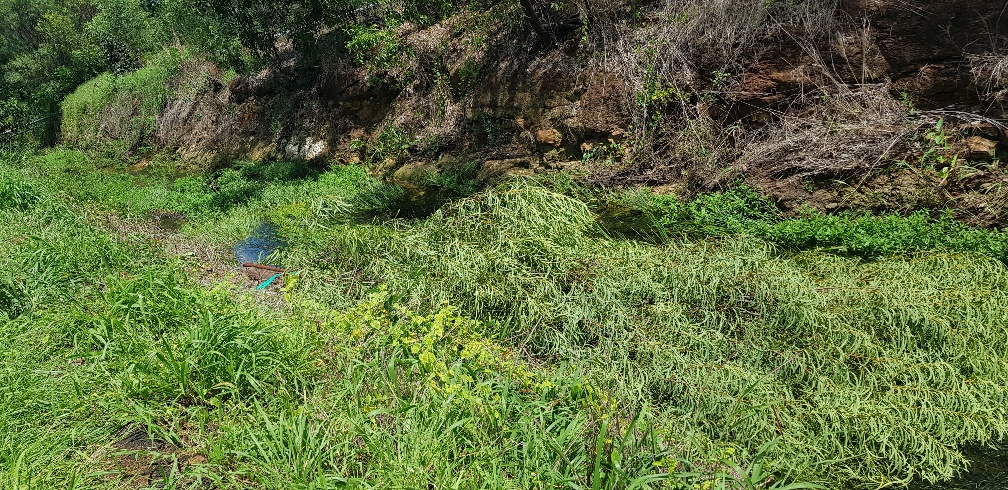 So, undertakings given by the former Lord Mayor and staff to ratepayers are just ignored by the current Lord Mayor and staff - how unimpressive.
COD stopped work after my complaint and sent out a flyer on 14 th December to neighbours and residents briefly explaining the intended works are to enable the creek drain to perform at its design capacity and then recommenced tree cutting and chipping with assurances from the COD that trees on the top and sides of the bank will be left to minimize visual impacts and provide erosion control.
Then on 4th and 5th January, an unsupervised contractor walked up the creek/drain with a chainsaw and cut down many Acacia trees on the sides and top of the creek/drain. The COD response to this broken undertaking were to call these trees “weeds”. See pictures of felled trees.
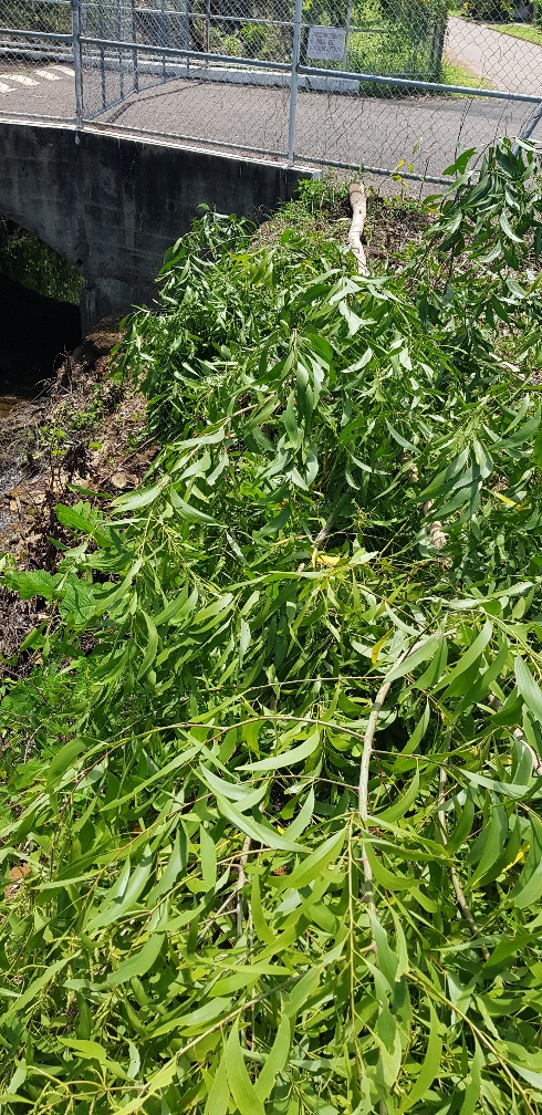 And as a major stakeholder in the area and next to the Playford street drain/ creek, presumably the Darwin Turf Club were not consulted by COD prior to starting these tree felling works which has removed the treed buffer zone between the DTC facilities and the neighbours.
Then COD advised on 7th January, that once all the tree felling and clearing is complete, that the bottom of the creek/drain will be dredged. This fact was conveniently omitted from the COD notice to residents on 14 December 2021.
I wonder what the next instalment will be in this horror movie that shows the COD greening our city policy in action?
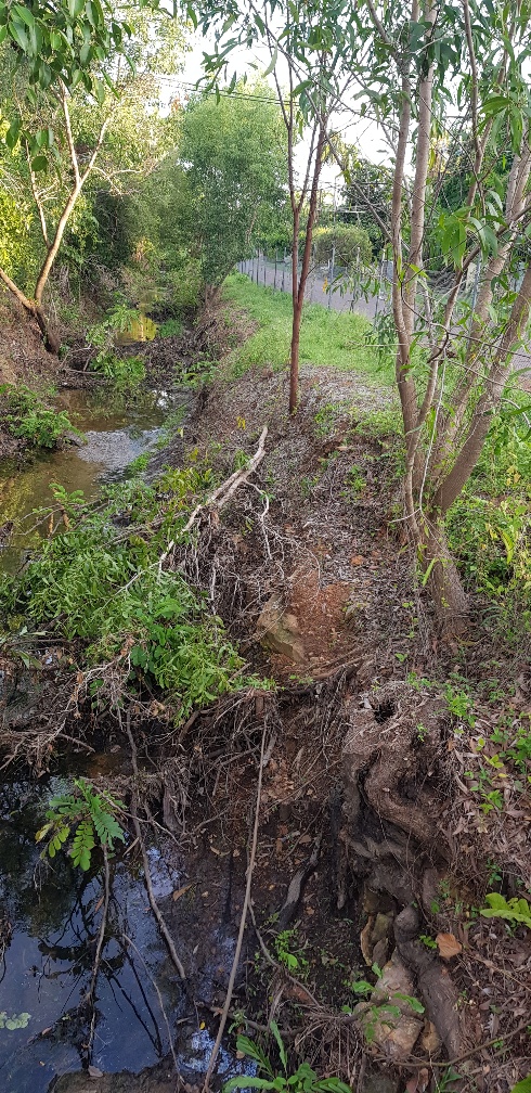 Meanwhile contractors are busy cutting trees, lifting them out with a crane and chipping them at a cost of $1000s per day. Yes, this is your rates at work. At the same time, COD has the tree seedling give aways and major landscaping programs to encourage a greener city and more flora and fauna – while at the same time destroying trees and habitat adjacent to Playford Street.
No COD Alderman, Lord Mayor or official has come to inspect these works and or discuss them with residents adjacent to these activities. The COD attempts to justify the works by saying they need to re-instate the creek/drain to its full capacity, presumably to protect houses from flood damage. But despite Cyclone Marcus and other big rain events, houses have not flooded. Sure, minor flooding of local roads can occur under huge rainfall events, but when the tide goes out, so does the flood water in the creek/ drain. It really is that simple.
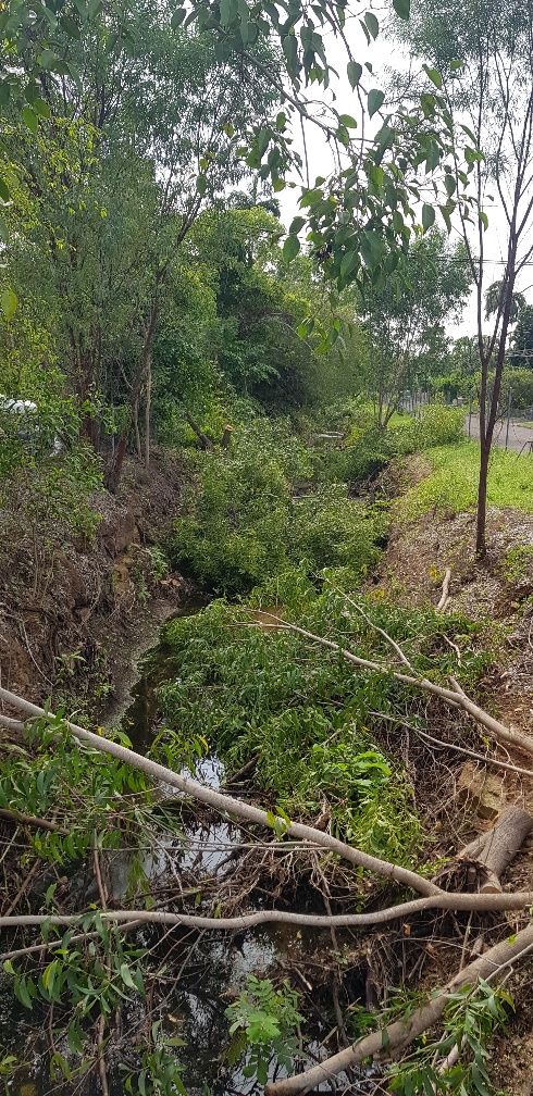 COD are wasting ratepayers’ money on a make work project and removing habitat and also removing the visual screen between the neighbours and the Darwin Turf Club Grandstand, carpark and Stalls area. So much tree debris from one tree cutting exercise was left in the drain / creek that it recently washed down to Buntine Avenue, which is the entrance to the DTC from Dick Ward drive, and it acted as a beaver type dam, totally blocking the 2 large pipes there. This caused the road to flood and the water nearly went into Silks.
Hence claims by the COD re their expert technical monitoring and supervision of this project are just nonsense.
And where is the COD Erosion Control and Sediment Plan to prevent sediment moving off site and to prevent erosion on the banks now that the trees have gone? Where are the NT EPA in this matter, who approved these works, the COD itself it seems and why are these works not shown on the COD projects web site? Where are the hydrology studies used to justify these works and where was the public environmental approval process for these works? Or is the COD now above the law and it doesn’t care about sediment moving offsite, its greening policy and impact upon neighbours?
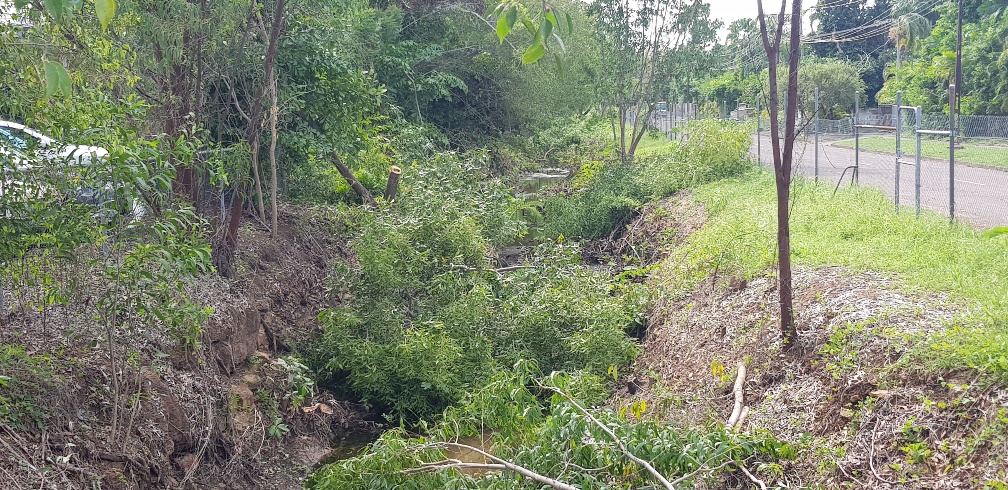 If the City of Darwin were sensible, they would stop wasting money, stop destroying habitat and the stability of the creek/ drain and work with the residents and the Darwin Turf Club to re-instate the trees and shrubs that have been unnecessarily removed. The residents are not against weed removal and tree removal in the base of the creek for stormwater flow.
But my guess is that the COD will keep doing what they are doing and wasting your rates as it appears to be someone’s pet project.
This work is NOT in the interests of ratepayers and should be stopped.
Geoff Farnell
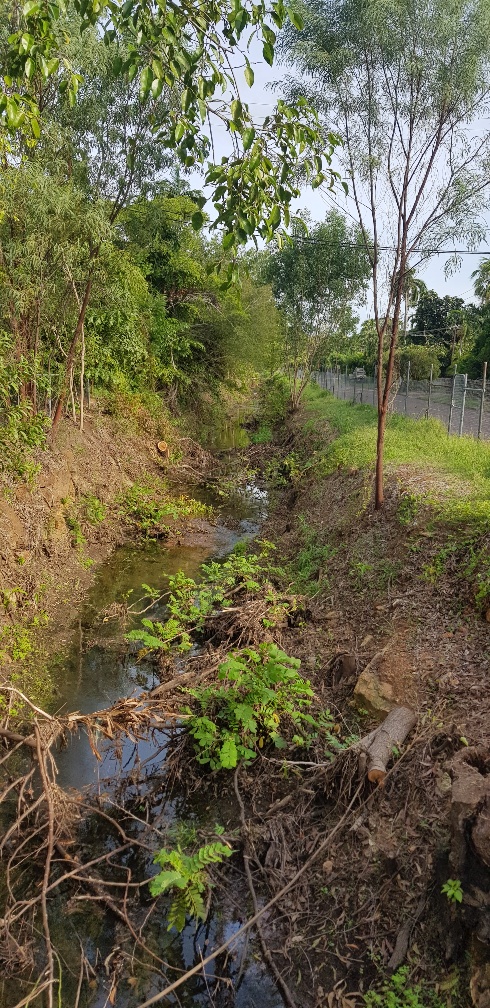
Posted in Community Alert
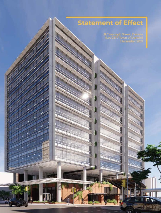
From the desk of Planning Reform Team, Department of Infrastructure, Planning and Logistics
This closes Midnight Friday, 4 March 2022
Here are the attachments:
images/documents/NTG/111907261_Detailed_Information_Paper.pdf
images/documents/NTG/111907263_Integrated_Schedule_of_Amendments.pdf
images/documents/NTG/111907277_Summary_Paper.pdf
images/documents/NTG/111907280_Appendix_C_-_Supplementary_Information.pdf
111907283_Appendix_B_-_Individual_Project_Amendments_-_Designing_Better.pdf
111907285_Appendix_A_-_Individual_Project_Amendments_-_Economic_Recovery_Actions.pdf
Here is an extract which appears to be concerning:
Establishing a Permitted Use Department of Infrastructure, Planning and Logistics Page 1 of 3
A permitted use under the NT Planning Scheme 2020 may not require a development permit.
However, if property is within a building control area, building certification may be required.
You don’t need a development permit for a permitted use if the development:
• meets all planning requirements, and
• does not require consent because of an overlay
Dear Stakeholder
We are excited to share with you that a planning scheme amendment for Planning Reform Phase 2 Stage 1 is now live and on public exhibition until midnight, Friday 4 March 2022.
The Minister for Infrastructure, Planning and Logistics has decided to consolidate 2 projects to form this amendment:
- Economic Recovery Actions project – the NT Planning Scheme 2020’s response to the recommendations of the Territory Economic Reconstruction Commission; and
- Designing Better project – the NT Planning Commission’s review of apartment and mixed use building design.
Both projects seek to improve processes and outcomes relating to the design of buildings and place.
You can view the documents and make a submission through Planning Notices Online.
We encourage you to read the Detailed Information Paper and associated documents, and make an appointment to speak with the Project Team about any clarifications, concerns or compliments. The Project Team will be exclusively available for booked appointments between Thursday 4 February and Friday 18 February 2022 across Darwin, Palmerston, Katherine and Alice Springs.
To book an appointment please visit haveyoursay.nt.gov.au.
If you have any questions about the proposal in the meantime, please feel free to contact the Project Team on (08) 8999 8963 or via This email address is being protected from spambots. You need JavaScript enabled to view it..
Thank you for your ongoing interest in Planning Reform and/or Designing Better, and we hope to talk with you soon to receive your feedback.
Kind regards,
Planning Reform Team
Posted in Community Alert
Infrastructure NT Commissioner Appointed
26 January 2022
The Territory Government has appointed Ms Louise McCormick to the role of Commissioner for Infrastructure NT.
Over the past 16 years Louise has worked in the Northern Territory, she has been involved in planning, delivery and management of some of the Territory’s largest and most complex infrastructure projects and has been instrumental in securing Australian Government funding for a significant road upgrades across the Northern Territory.
We have established the Territory Investment and Major Project Commissioners to actively pursue investment and drive major projects in the Territory. The Infrastructure NT Commissioner will ensure we build the public infrastructure needed to deliver those important job-creating projects, providing a crucial link to achieving the NT Government’s goal of a $40 billion economy by 2030.
The immediate work the Infrastructure Commissioner will undertake is:
- Build on infrastructure work that Government has already done, and have a strategic approach to creating jobs and planning for the future.
- Work in conjunction with the Major Project Commissioner to win projects and make them happen.
- Establish a strategically focussed professional team that will represent the Northern Territory in national discussions to ensure our public infrastructure requirements have Commonwealth and broader community support, including submissions to Infrastructure Australia for priority project listing;
- Develop a new Territory Infrastructure Strategy incorporating agency Strategic Infrastructure Plans, to get the right infrastructure built at the right time, in the right place to support productivity, economic growth and regional sustainability;
- Oversee business cases and concept plans for ‘shovel worthy’ government projects underpinned by appropriate community engagement and planning through the regional recovery committees.
- Review and define processes to assess and prioritise all major publicly funded infrastructure investment proposals.
Infrastructure NT will establish strong relationships at the national level with the relevant Australian Government agencies and other jurisdictions to ensure that the Territory is front and centre as Australia’s comeback capital.
Quotes from the Minister for Infrastructure, Planning and Logistics, Eva Lawler:
“Quality projects that enable economic development are important to the Northern Territory’s bounce back. We are well positioned to become Australia’s comeback capital.
“Louise McCormick is an asset to the Territory, with over 20 years’ experience in the transport and infrastructure sectors, and I congratulate Louise on her appointment to the role of Commissioner for Infrastructure NT.
“Louise is a multi-award winning Chartered Engineer in both civil and structural engineering, and is well placed to lead the Infrastructure NT Commission to work with the Australian Government and private sector secure and deliver critical infrastructure development in the Territory.
“We are a Government who is doing the work and making sure the Northern Territory is positioned to win projects and investment, which is in the interests of Territorians, jobs, business and our future.”
Quotes from Infrastructure Commissioner, Louise McCormick:
“The Territory is the land of opportunity and infrastructure plays a key role in unlocking those opportunities. Focussing on strategic infrastructure planning and investment will pivot the Territory towards long-term sustainable economic and population growth.
“Working closely with potential investors, industry, the community and my colleagues across both the Northern Territory and Australian Governments will be essential to achieving the best outcomes for the Territory.’
Quotes from Infrastructure Australia CEO, Romilly Madew:
“A long-term advocate for the Territory, Louise has engaged constructively with Infrastructure Australia for several years and was a key member of the Working Group that guided the development of our new Assessment Framework for major infrastructure projects.
“As highlighted in the 2021 Australian Infrastructure Plan, targeted infrastructure investment and reform in the Northern Territory will be absolutely key to developing new industries, enhancing connectivity and liveability and supporting the national economic recovery effort. Louise is exceptionally well-placed to lead Infrastructure NT during this critical time.”
Posted in Blog & Opinion
Hello,
Here is a quick round up of PLan related activities for this week.
Save Little Mindil
Save Little Mindil NTEPA Submissions close midnight Tuesday 2nd November.
There are just a few days until the NTEPA (Northern Territory Environmental Protection Authority) consultation on the Little Mindil fiasco closes.
It is vital that the NTEPA understands how disenfranchised the community has become in this process. If you submit you are recognised as part of the community.
Your submission should be sent to This email address is being protected from spambots. You need JavaScript enabled to view it. before midnight 2 November 2021.
There are many hundreds of pages of information in the proposed developer’s package. This can be read here: https://ntepa.nt.gov.au/consultation/north-one-hotel-and-apartments
There is a set here also: https://planinc.org.au/news/current-campaigns-2/291-little-mindil-under-threat.html
Here are some key points you may consider for your submission:
• The proponent has failed to provide the community consultation required by NTEPA. Note EP Act Section 43 see the end of this page.
• There is inadequate time in the NTEPA process for the community to respond with any understanding of the project.
• There was a rezone that the public knew nothing about after the NTG was consulted by the applicant.
• There was a covenant over the open space which was removed last year with no notification or consulation to the community.
• Ten years ago, it was declared not possible to put a road from the Gilruth Avenue hill into Little Mindil. That is why we now drive through the casino grounds to get access.
• The ground is heavily polluted with seawater and many years of dumped materials in the ground.
• Noise levels will increase significantly.
• The creek is not depicted on any drawings near the proposed roadworks.
• The escarpment may well be affected by road construction and the undergrounding of the power lines at the escarpment base.
• The development seeks reduced setbacks at the escarpment and Gilruth Avenue.
• There is no public parking to facilitate the guaranteed public access to the foreshore.
• There is inadequate parking for the number of units proposed.
• There is no mention of global warming or the dangers of building in the storm surge zone.
• It is likely that no location in Australia would allow such a development so close to the water line, let alone in a cyclone area.
• The resultant building may not be insurable.
• Who is responsible for remediation to damage to the break walls and how will heavy vehicles get access to the coastline? Is the development placing a burden on the public purse to remediate as has happened in northern beaches Sydney and the Gold Coast amongst other locations? See They’ve Kerbed And Guttered Narrabeen Beach for a recent instance.
• The drawings supplied are not to scale and some drawings contain two scales.
• A1 sized drawings should be available to all interested parties.
• The buidings are three storeys above the height of the escarpment blocking views from the Heritage Precinct.
• The Green belt will be destroyed in the area.
• The buildings will be visible from many locations.
• The buildings do not contribute in anyway to the amenity of the whole area.
• Shared Public access to the whole of the block including public parking was guaranteed by previous government.
Flyers
The Little Mindil Flyers have arrived. Public awareness is critical to saving Little Mindil. Please write back if you can do your street or more.
Also, we need to get the flyers into all the coffee shops, restaurants and notice boards in the CBD and suburbs.
We can drop the flyers off to your address in lots of 100 or more.
Welcome back Shorebirds
Birdlife Top End, Save Lee Point and PLan
Sunday November 7th, 4.30pm - 6.30pm, Lee Point Beach
Come down to Lee Point Beach to welcome the shorebirds back to the beaches of North Australia.
This event will give you an opportunity to view the amazing birds that have journeyed thousands of kilometers to be feed and roost on our beaches.
There will be free food and activities for kids.
All are welcome, not just the shorebirds!
Welcome Back Shorebirds Flyer
Mitchell Park Botanical Gardens/Nature Park initiative
An effort to make the suburb of Mitchell and the neighbouring part of Litchfield Shire into a nature park/botanical gardens has commenced.
Meetings
Just a quick reminder that the first of the regular get together meetings will be at the Palmerston Library on the 2nd and 4th Wednesdays of each month at this venue. Please pass the word around.
Hope to see you there.
Kindest regards,
Jim Young
0439 776 025
For more information see here: https://planinc.org.au/news/mitchell-park.html
Memberships
The 2022 Memberships are open, pay today and become a member until Christmas 2022. As a volunteer organization we rely on the community to assist us in our efforts. Please see here: Membership and Donations
PLan collaborates with resident and community groups on matters including the built environment, heritage, cultural and environmental values of concern in the Northern Territory and Australia. PLan’s aim is to achieve, for the community, sustainability in terms of social, cultural, environmental and balanced long term economic impacts.
Environmental Protection Act 2019. Section 43.
'43 General duty of proponents
A proponent of an action has the following general duties under an environmental impact assessment process:
(a) to provide communities that may be affected by a proposed action with information and opportunities for consultation to assist each community's understanding of the proposed action and its potential impacts and benefits;
(b) to consult with affected communities, including Aboriginal communities, in a culturally appropriate manner;
(c) to seek and document community knowledge and understanding (including scientific and traditional knowledge and understanding) of the natural and cultural values of areas that may be impacted by the proposed action;
(d) to address Aboriginal values and the rights and interests of Aboriginal communities in relation to areas that may be impacted by the proposed action;
(e) to consider the principles of ecologically sustainable development in the design of the proposed action;
(f) to apply the environmental decision-making hierarchy in the design of the proposed action;
(g) to consider the waste management hierarchy in the design of the proposed action.’
Regards,
Nick Kirlew
Convener PLan: the Planning Action Network Inc
0447 499 794
Email: This email address is being protected from spambots. You need JavaScript enabled to view it.
Web: https://www.planinc.org.au
Posted in Blog & Opinion