Category: News
-
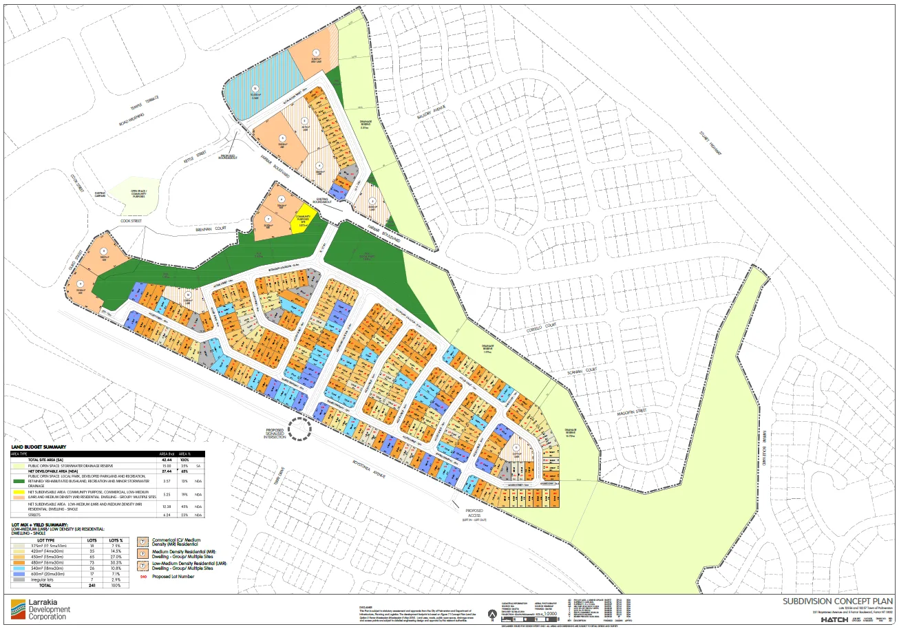
Farrar West Development
Contents Here is the link to the petition: https://actionnetwork.org/petitions/friends-of-farrar/ On this page you can find links to the previous events Next comes the application documents After that we have published an Overview & Site Parameters Return to this page to see the to be developed Submission Guide Petition and Previous Events See here for previous…
-

Friends of Farrar
Update: The pink signs are up, see this page for the documents: https://planinc.org.au/farrar-west-development/ Previously We need you!! Join us to CONNECT and PROTECT our beautiful suburb of Farrar. We invite you to join the residents of Farrar for our Farrar Community event. Where: Phyllis Uren Park, Farrar When: Saturday, 3rd October time. 10am-12pm RSVP: 30th…
-
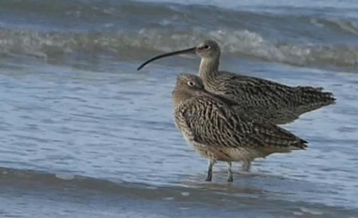
Senate Inquiry into the Management of Defence estate assets
The inquiry has been extended to 27 February 2027. The committee secretariat confirmed to me on 14 September that, although the formal deadline has passed, the committee has agreed to continue accepting submissions about Lee Point/Binybara. I am writing on behalf of PLan about the Senate Inquiry into the Management of Defence estate assets. The…
-

-
7 Waratah Crescent, Fannie Bay
Letter to the editor as published: https://ntindependent.com.au/letter-to-the-editor-give-pearl-land-to-expand-aged-care-services/ To the Editor, Lands and Planning Minister Josh Burgoyne has now responded to community calls for a public-interest assessment before the Land Development Corporation sells the remaining public land at 7 Waratah Crescent, Fannie Bay, beside Southern Cross Care’s Pearl aged-care and retirement community. The minister states that…
-
Another Bottom of the Harbour Scheme.
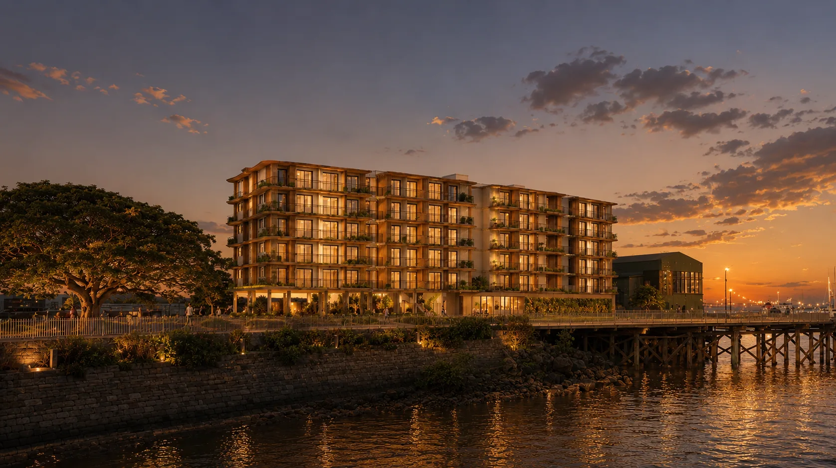
Community Group Challenges Decision to Count Ocean Water as Public Open Space DARWIN, NT — The Planning Action Network (PLan) has called out a planning interpretation that allows ocean water below the high tide mark to satisfy statutory public open space requirements for a commercial hotel development on Stokes Hill Road. At a Development Consent…
-
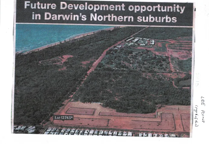
Historical Aerial: Lee Point Corridor & Lot 12743 (c. 2010)
Key Visual Markers Confirming the Era The photo captures the boundary of Darwin’s northern growth corridor right at the moment the transition from Lyons/Muirhead into the broader Lee Point peninsula planning framework was being publicly advertised.
-
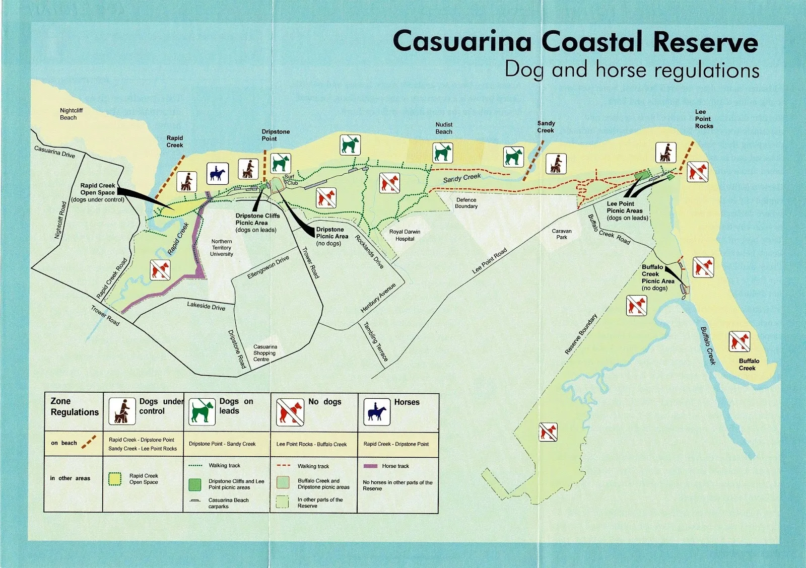
Casuarina Coastal Reserve Regulatory Map
Coverage: Coastal strip spanning Nightcliff Beach, Rapid Creek, Dripstone Point, Sandy Creek, Lee Point Rocks, and Buffalo Creek. Dog Regulations: Restricts dogs off-lead at Nightcliff/Rapid Creek, requires leads at Dripstone and Lee Point picnic areas, and bans dogs completely at Dripstone Picnic Area and Buffalo Creek. Horse & Recreational Access: Permits horses exclusively on the…
-
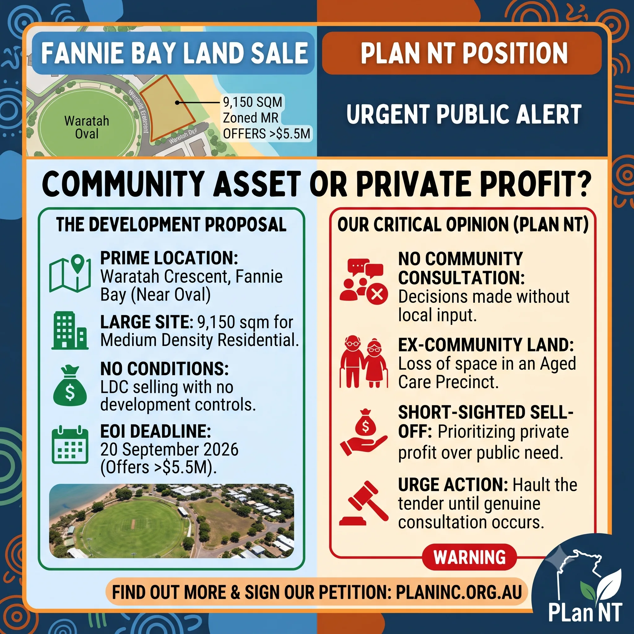
Community Asset or Private Profit? The Sell-Off of Fannie Bay’s 7 Waratah Crescent Land
Sign the petition here: Fannie Bay Land Up for Sale The Land Development Corporation (LDC) has officially opened an Expression of Interest (EOI) process for a prime residential development site at 7 Waratah Crescent, Fannie Bay. Located just 5.8 km from the Darwin CBD and overlooking Waratah Oval, the 9,150-square-metre site is being marketed as…
-
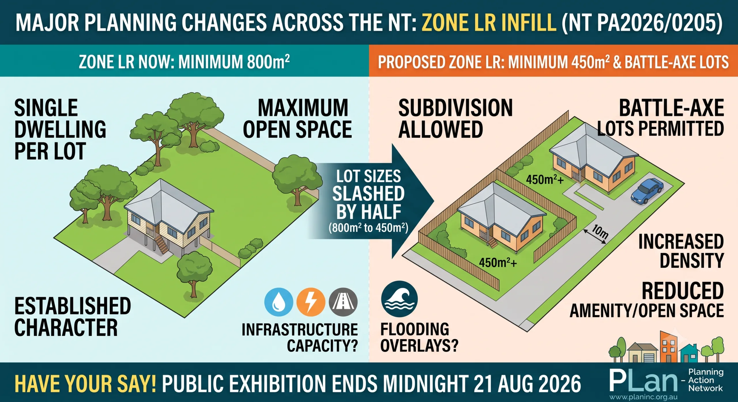
450m² Lot Sizes and Battle-Axe Lots: What the Proposed Zone LR Changes Mean for Territory Suburbs
Planning Scheme Amendment PA2026/0205 is the formal exhibition process by the Northern Territory Government to introduce policy changes enabling infill development and subdivision within Zone LR (Low Density Residential) across the Territory. 1/10/2026 1/10/2026 verbal submission These are my talking points which I presented at this mornings hearing: Good morning Chair and Commissioners. I am…