-
PLan is an incorporated voluntary organization working towards a better living environment. Our Financial year is from 1 July to 30 June each year. Membership is only $25 per year. 2025 year now open – renew or join now and…
-
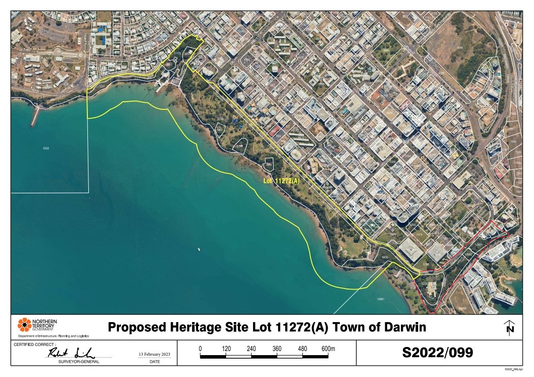
2024 05 Esplanade Statement of Heritage Value
Update 18/12/2024 Department of Lands, Planning and Environment Heritage Council speaks to the Supreme Court decision on the Darwin Esplanade 17 December 2024 Background On 3 December 2021 the Heritage Council accepted a nomination from a member of the public…
-
2024 07 Strategic Directions Planning Policy
This submission closes 31 July 2024. https://haveyoursay.nt.gov.au/strategic-directions-planning-policy At this stage we have yet to engage with this process, please return to this web site in the future. StrategicDirections download the pdf.
-
Limits to public scrutiny in the Northern Territory planning system
There are clear limits to public scrutiny in the Northern Territory planning system. Despite Minister Burgoyne’s claim that the Planning Act 1999 contains “robust provisions for public consultation and input”, recent experience suggests that this is not how the system…
-
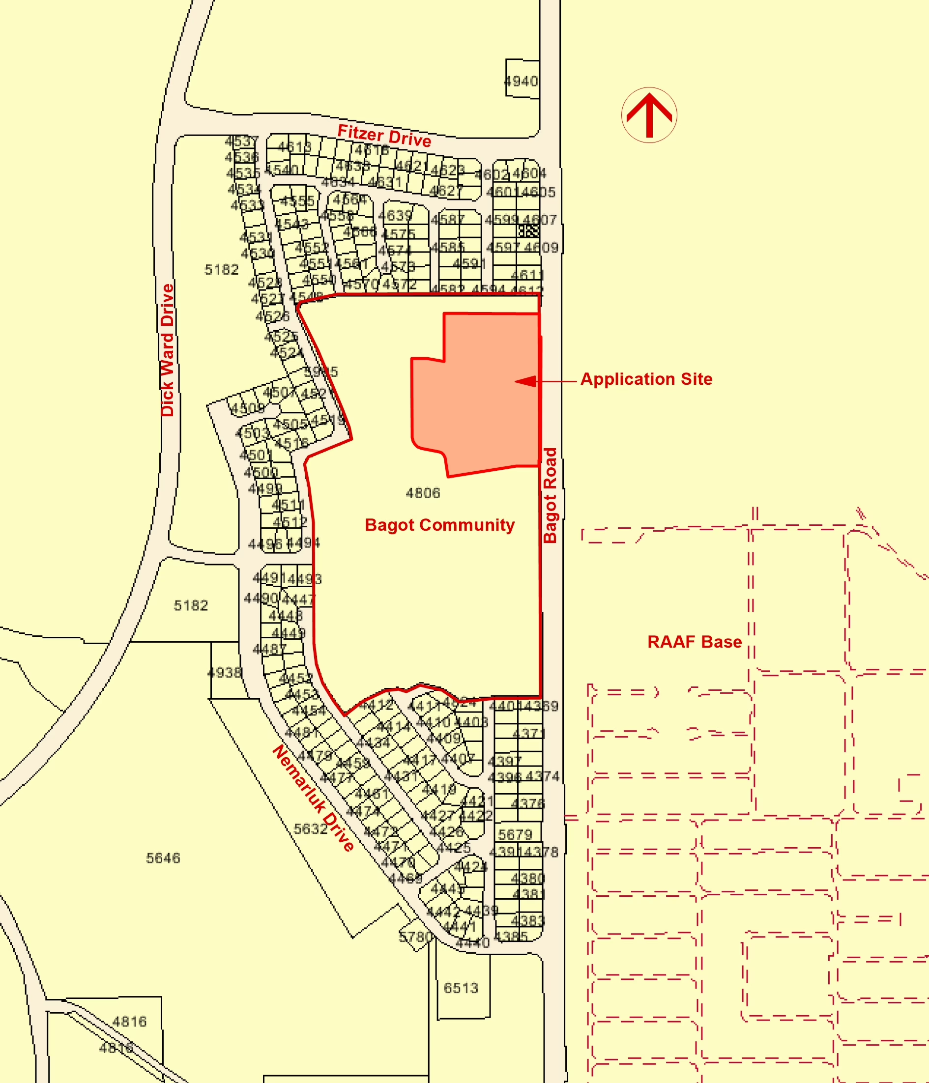
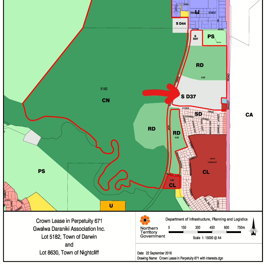
PA2025/0161 – Lot 4806 (133) Bagot Road – Protecting Our Community: The 133 Bagot Road Rezoning Proposal
The Proposal: A New Commercial Hub on Community Land An application has been submitted to rezone a 5.0-hectare portion of Lot 4806 (133 Bagot Road) from Zone CL (Community Living) to Zone C (Commercial). The proponent, June D’Rozario & Associates,…
-

URGENT: Call for Senate Inquiry into $400M Lee Point Housing Project
By PLan: the Planning Action Network Inc. | March 27, 2026 The future of Darwin’s last major wildlife corridor is at a breaking point. Despite overwhelming community opposition and significant cultural concerns from Larrakia Traditional Owners, Defence Housing Australia (DHA)…
-
The Planning Prince: Tackling Darwin’s Dead Spots.
In a recent interview with ABC Radio Darwin’s Jess Ong, PLan Convener Nick Kirlew addressed a growing concern for residents and visitors alike: the long-term vacant lots and “pits” scattered across the CBD. From the infamous “big hole” on Mitchell…
-
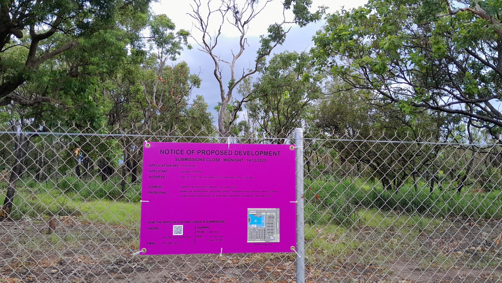
URGENT: PLan Demands Reconvening of Ludmilla DCA Hearing Following Intimidation and Procedural Failures
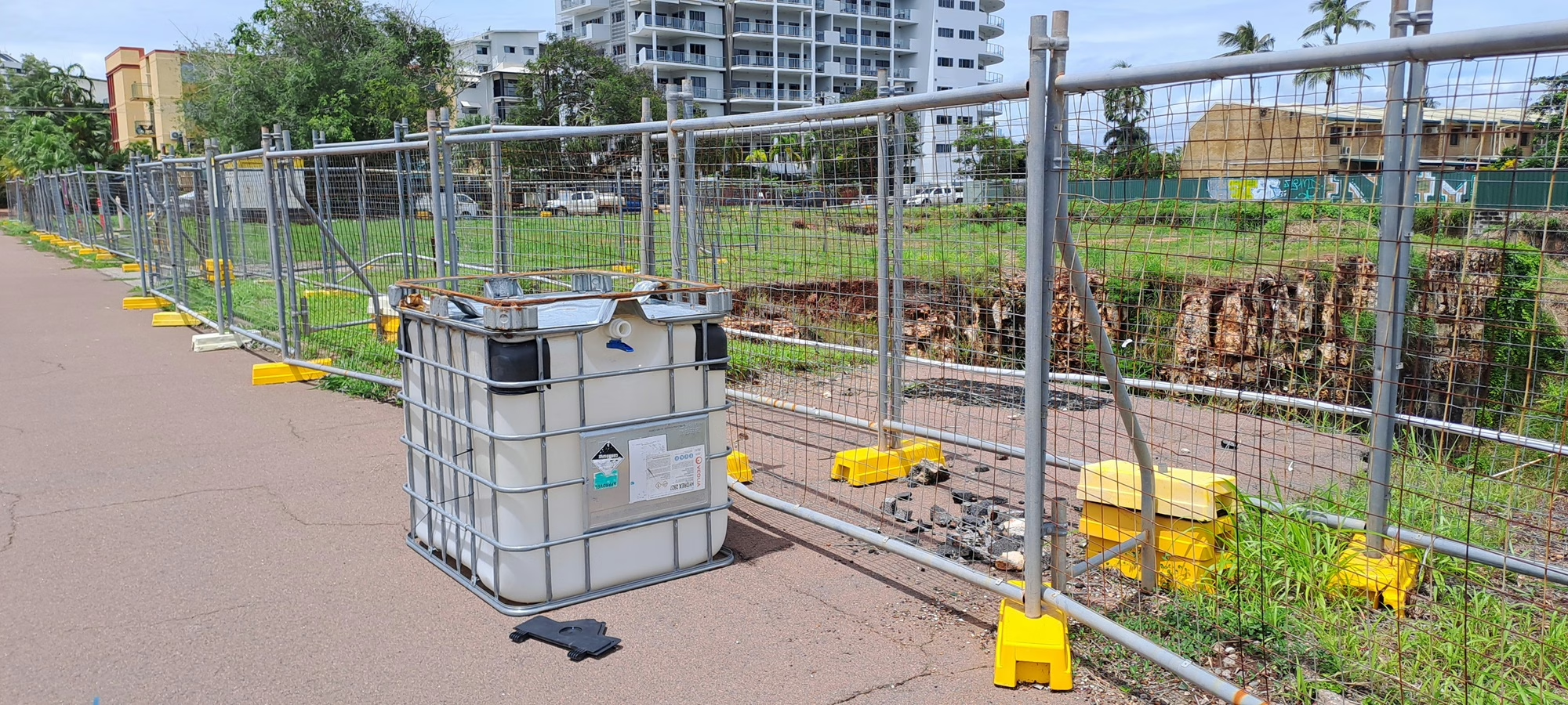
DARWIN — Sunday, 8 March 2026 PLan: the Planning Action Network Inc. has formally requested that the Development Consent Authority (DCA) reconvene the hearing for PA2025/0441 (Ludmilla Bush Block), following a total collapse of procedural fairness at the public hearing…
-
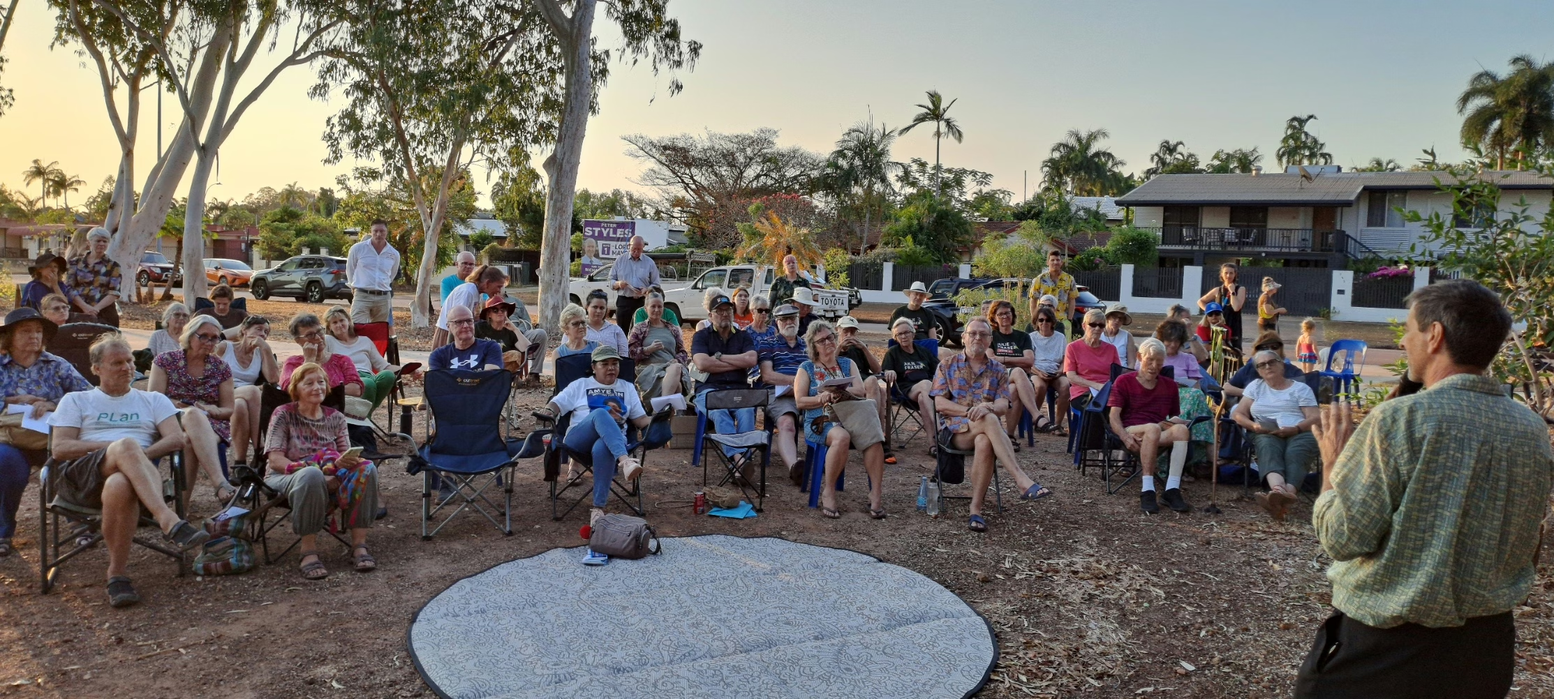
PLan’s Meetings
PLan meetings are held on the first Thursday of every month. 4:30pm at Justine Davies Community Office, Bagot Road Millner. Next Meeting is Thursday 5th March 2026. All welcome.
-
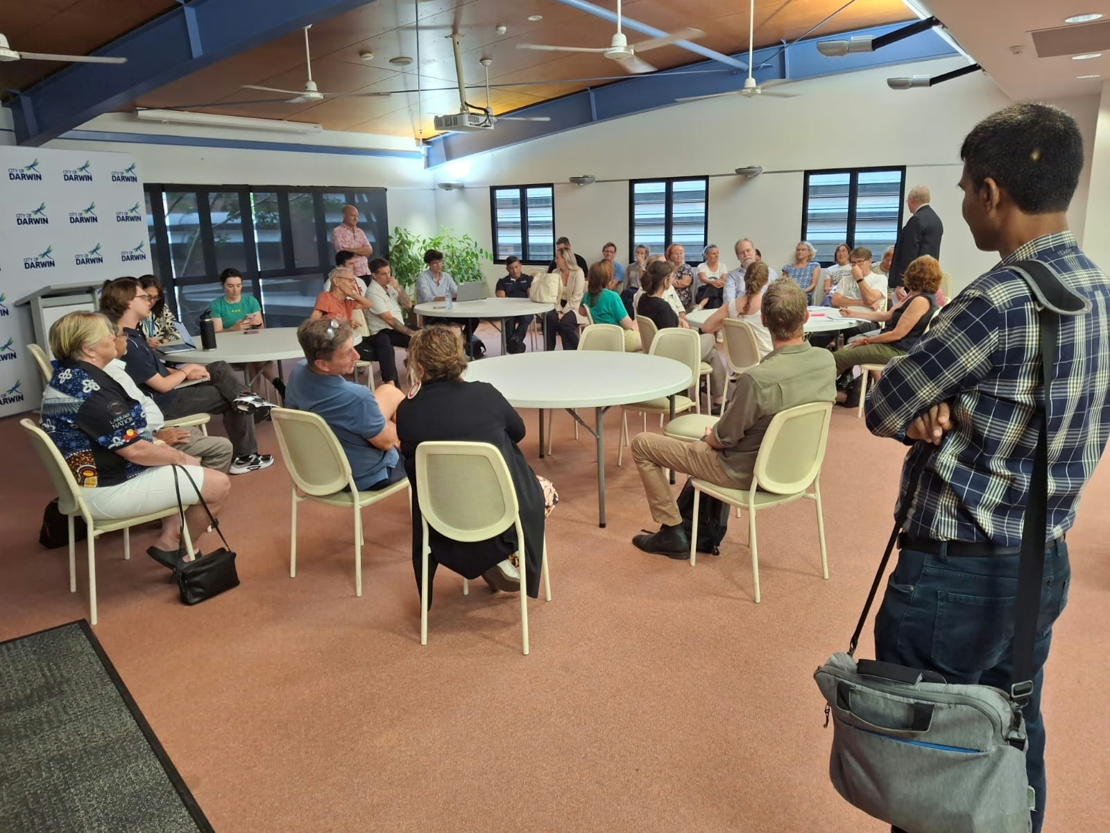
Bullying Tactics and Decade-Old Data: A Night of Defiance at City of Darwin
Wednesday, February 25, 2026 The battle for the future of Lee Point reached a fever pitch at the City of Darwin on Tuesday night, as community members were met with a combination of procedural “bullying” from the Chair and a…
-
Volunteer Opportunity: Digital Advocacy & Community Growth
Organization: PLan: the Planning Action Network Inc. Location: Darwin / Remote (Flexible) Project Theme: Power in Numbers About the Role: PLan has been the community’s planning watchdog in Darwin for over 30 years. From protecting the Ludmilla bush block to…
-
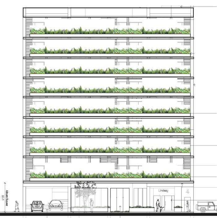
4 Lindsay Street
COMMUNITY ALERT: 4 Lindsay Street – A Case of “Planning Retreat” by Stealth? Proposal: 75 Serviced Apartments in a 9-Storey Building Location: Lot 1462 (4) Lindsay Street, Town of Darwin PLan: the Planning Action Network Inc. has formally lodged a…
-
Kulaluk Update Feb 2026
At time of writing we are getting close to the hearing for PA2025/0441Bagot Road Masterplan variation and DA Stage 1 Below are documents that have been made available. Some random comments: I would point out that the quality of the…
Join 900+ subscribers
Stay in the loop with everything you need to know.