Author: PLan
-

-
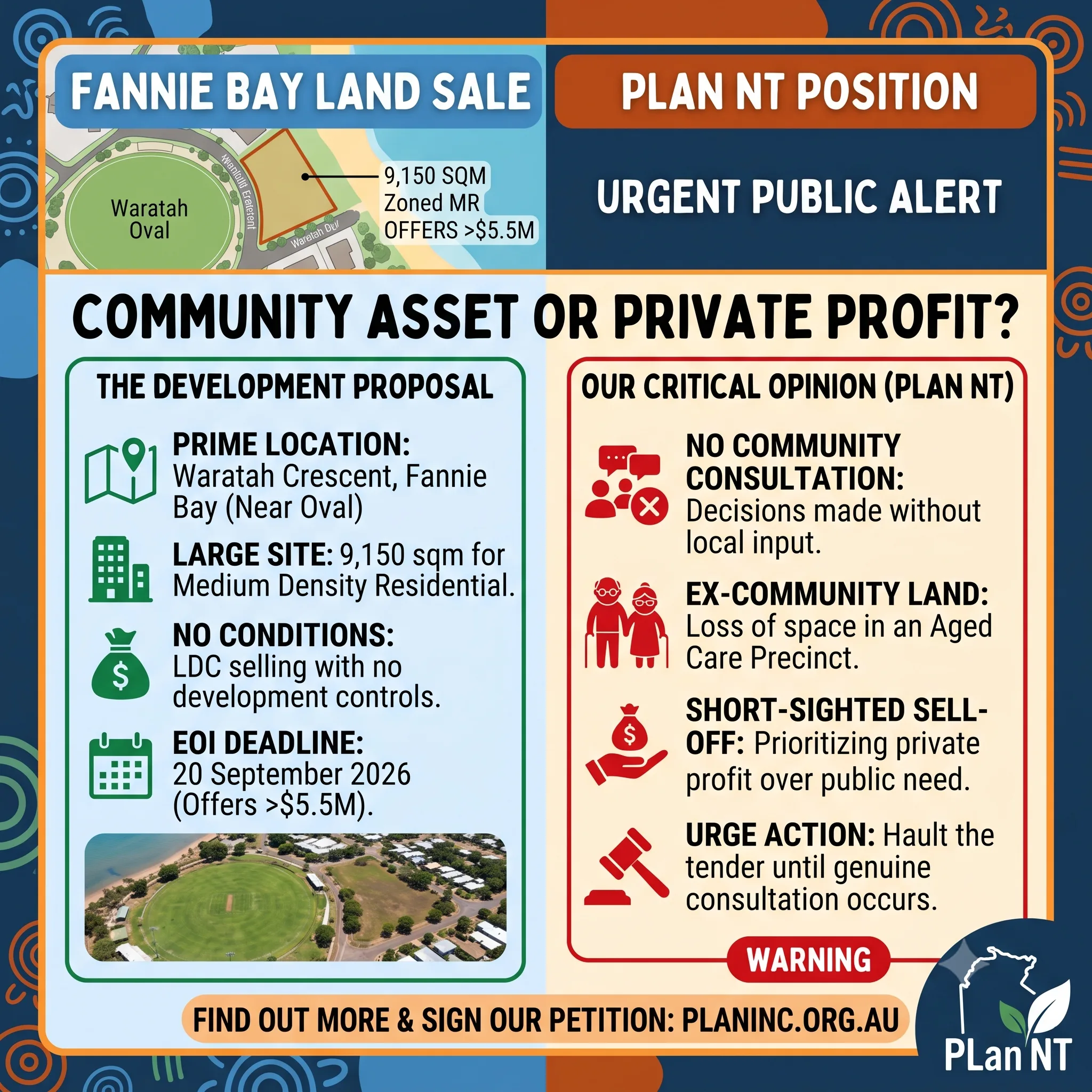
7 Waratah Crescent, Fannie Bay
Letter to the editor as published: https://ntindependent.com.au/letter-to-the-editor-give-pearl-land-to-expand-aged-care-services/ To the Editor, Lands and Planning Minister Josh Burgoyne has now responded to community calls for a public-interest assessment before the Land Development Corporation sells the remaining public land at 7 Waratah Crescent, Fannie Bay, beside Southern Cross Care’s Pearl aged-care and retirement community. The minister states that…
-
Another Bottom of the Harbour Scheme.
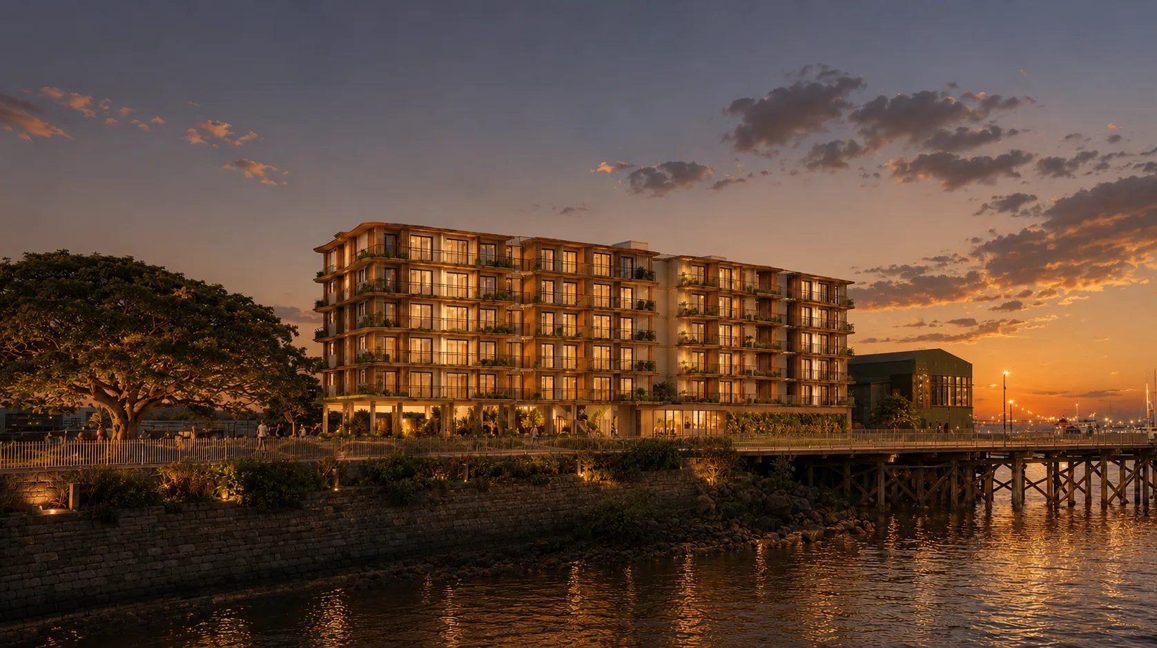
Community Group Challenges Decision to Count Ocean Water as Public Open Space DARWIN, NT — The Planning Action Network (PLan) has called out a planning interpretation that allows ocean water below the high tide mark to satisfy statutory public open space requirements for a commercial hotel development on Stokes Hill Road. At a Development Consent…
-
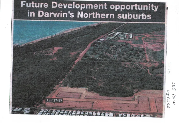
Historical Aerial: Lee Point Corridor & Lot 12743 (c. 2010)
Key Visual Markers Confirming the Era The photo captures the boundary of Darwin’s northern growth corridor right at the moment the transition from Lyons/Muirhead into the broader Lee Point peninsula planning framework was being publicly advertised.
-
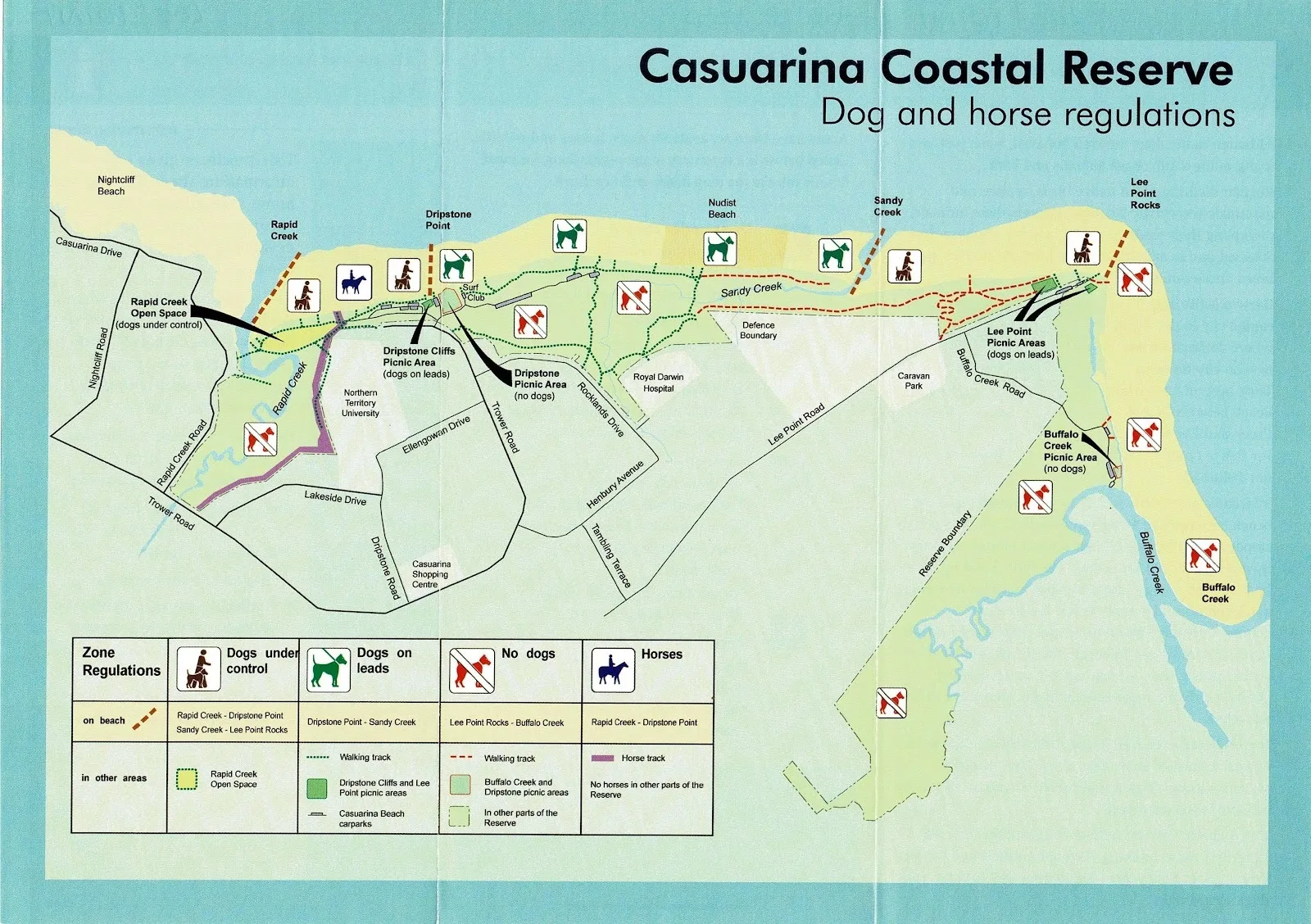
Casuarina Coastal Reserve Regulatory Map
Coverage: Coastal strip spanning Nightcliff Beach, Rapid Creek, Dripstone Point, Sandy Creek, Lee Point Rocks, and Buffalo Creek. Dog Regulations: Restricts dogs off-lead at Nightcliff/Rapid Creek, requires leads at Dripstone and Lee Point picnic areas, and bans dogs completely at Dripstone Picnic Area and Buffalo Creek. Horse & Recreational Access: Permits horses exclusively on the…
-
Community Asset or Private Profit? The Sell-Off of Fannie Bay’s 7 Waratah Crescent Land
Sign the petition here: Fannie Bay Land Up for Sale The Land Development Corporation (LDC) has officially opened an Expression of Interest (EOI) process for a prime residential development site at 7 Waratah Crescent, Fannie Bay. Located just 5.8 km from the Darwin CBD and overlooking Waratah Oval, the 9,150-square-metre site is being marketed as…
-
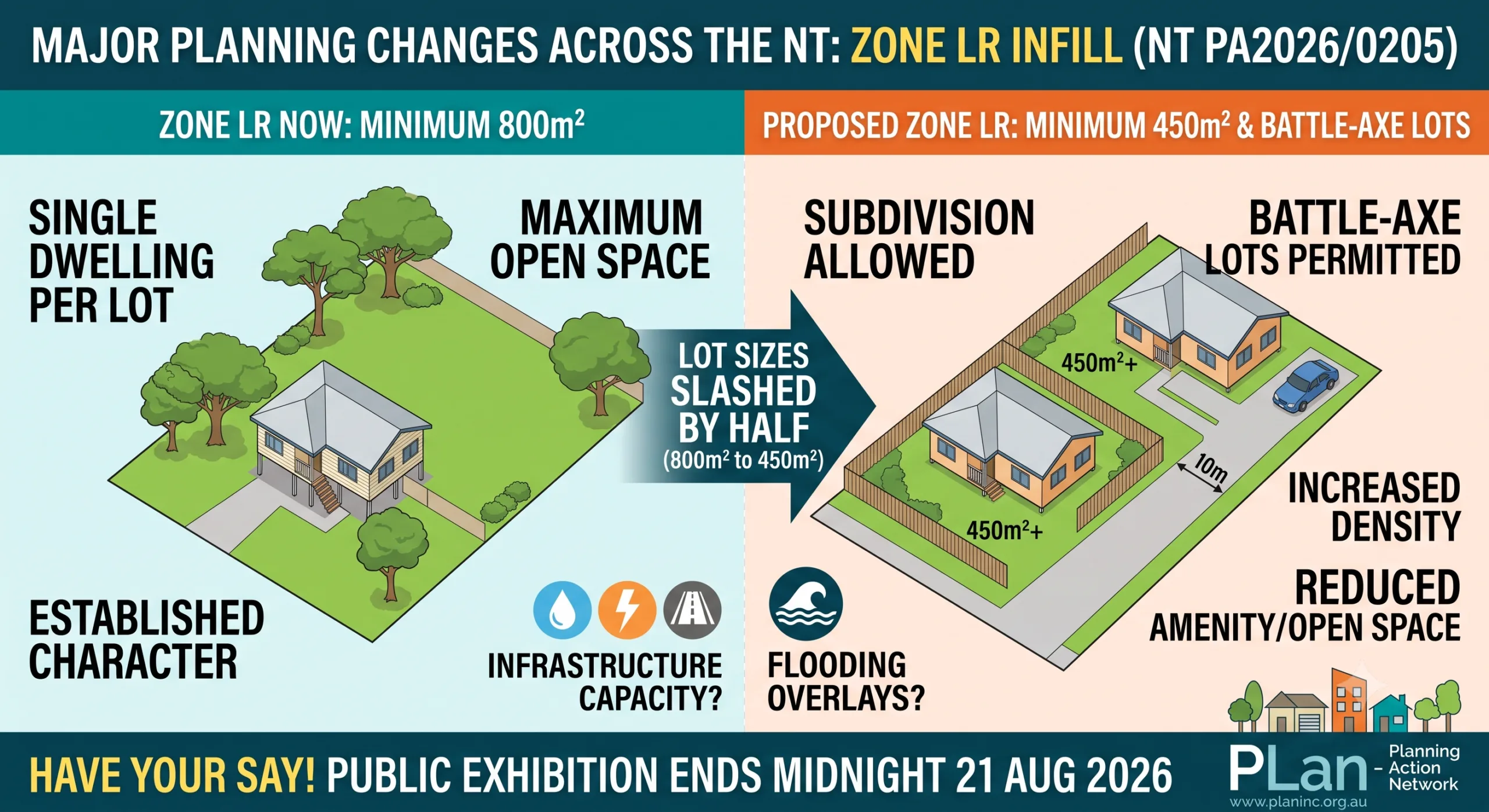
450m² Lot Sizes and Battle-Axe Lots: What the Proposed Zone LR Changes Mean for Territory Suburbs
Planning Scheme Amendment PA2026/0205 is the formal exhibition process by the Northern Territory Government to introduce policy changes enabling infill development and subdivision within Zone LR (Low Density Residential) across the Territory. In the end we sent to the following email addresses (noting confusuion from community): planning.ntg@nt.gov.au; Das NTG das.ntg@nt.gov.au; ntpc@nt.gov.au Here is our final…
-
Proposed Direct Sale of Crown Land (39ha) to Defence Housing Australia (DHA) – Lee Point
Executive Director Crown Land Estate Department of Lands, Planning and Environment Dear Executive Director, SUBMISSION OF OBJECTION Proposed Direct Sale of Crown Land (39ha) to Defence Housing Australia (DHA) – Lee Point 1. Failure to Meet the Principle of “Additionality” and “Conservation Gain” The proposed direct sale involves transferring 39 hectares of existing Crown land…
-
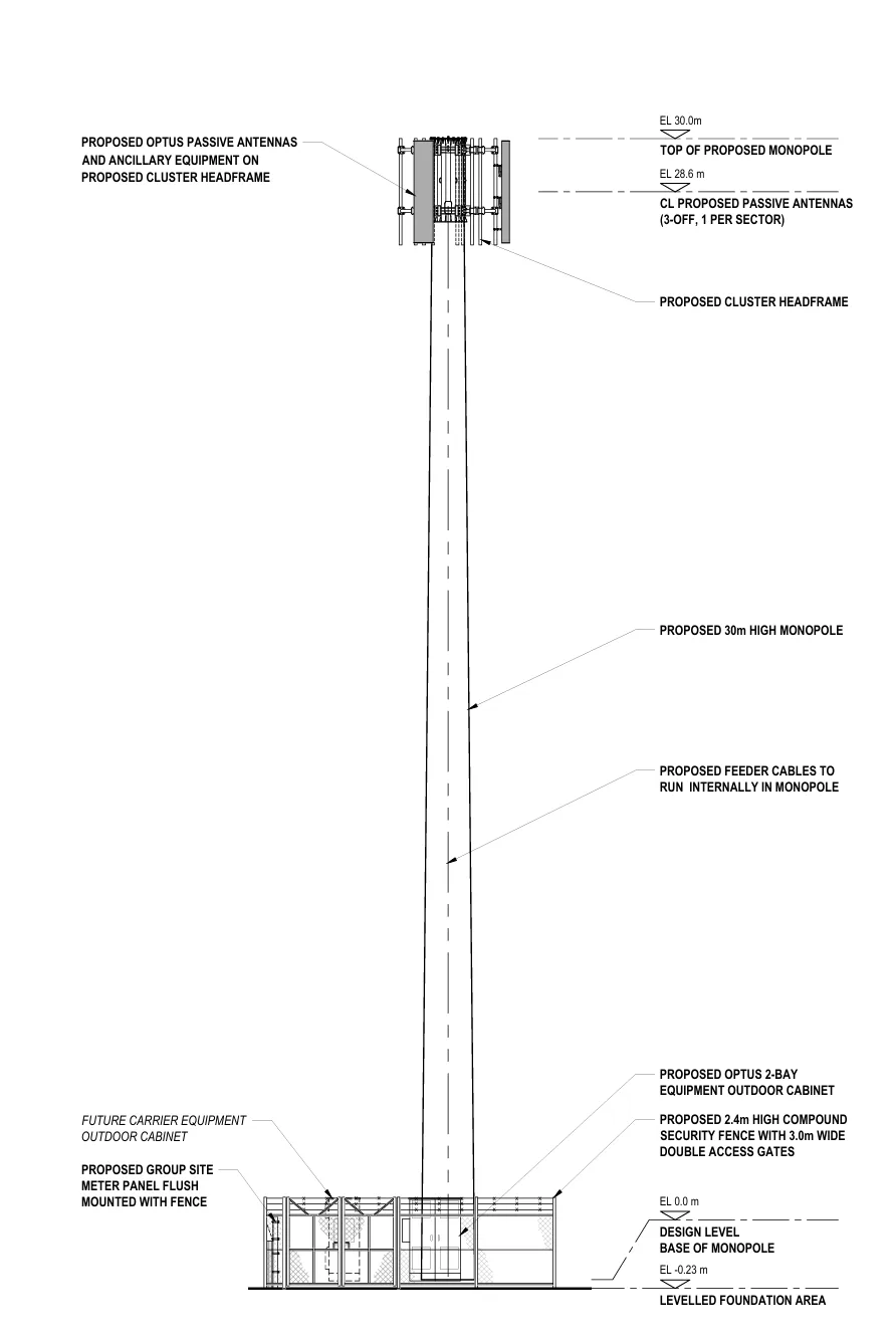
PLan Fights for Smart Infrastructure at Tracy Village
Exhibition Period: Friday, 26 June 2026 – Midnight Friday, 10 July 2026 Address: Lot 09775 Town of Nightcliff 28 TAMBLING TCE LYONS Current Zones: MZ (Multi Zone) Proposed Development: Telecommunications facility with 30m high monopole and associated antennas and equipment shelters FORMAL SUBMISSION TO THE DEVELOPMENT CONSENT AUTHORITY To: The Chairperson Development Consent Authority (Darwin…
-

Rival bids for crown land – Lee Point/Binybara
Larrakia Traditional Owners make rival bids for crown land surrounding Lee Point following Defence Housing Australia environmental offset plan Rival applications have been launched by both Territory Traditional Owners and developers over patches of crown land. Read why these blocks could be one of the final barriers to the controversial 800-home development. From NT News…