
REVIEW
Lee Point Peninsula is approximately 17 kilometres north of Darwin CBD and consists of 81 hectares. The peninsula is a broad, low crest running in a north/east, south/west direction with a maximum elevation of 32m. There are relatively steep slopes on the northwest coastline, while the slopes are more gentle south and east. The Beagle Gulf lies to the west and north and Buffalo Creek and Leanyer Swamp lies to the east.
History
Lee Point encompasses Dariba Nunggalinya (Old Man Rock) and is on Larrakia country.
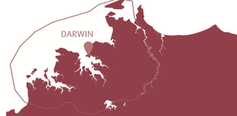
Image 1: Map of Larrakia country.
The Darwin area belongs to the Larrakia people. Tindale (1974:230) recorded that their land was from Fog Bay in the west to Gunn Point in the east and to an area north of Rum Jungle in the south. Foelsche (1881) and Basedow (1907) both noted that the Larrakia people were heavily dependent on fish and shellfish. Preferred camping areas were located near permanent water sources (Foelsche 1881) and sand ridges along the beaches. Resources used in the areas were fish, ducks geese, water lilies and wallabies often ambushed along well-used paths to water. Items of material culture likely to be preserved in the archaeological record include stone artefacts such as spearheads and stone axes, shell mounds, and 4 hearths made of stone or lumps of termite mounds (Foelsche 1881, Basedow 1907). Foelsche (1881:5-6) recorded that the Larrakia buried their dead in shallow graves, presumably in sand deposits found in coastal areas. The only items used to facilitate the subsistence activities described above that are likely to survive in the archaeological record are shell fish hooks, hearths containing cooking stone or termites nests and stone tools such as spear heads, axe heads, knives and, grindstones. Other items used in the daily life of the Aboriginal people in the past that are unlikely to have survived are wooden spears, digging sticks and small bags and nets.
The name ‘Lee Point’ appears on Goyder’s 1869 Plan of Port Darwin and probably dates to Stokes’ examination of the Harbour in 1839.
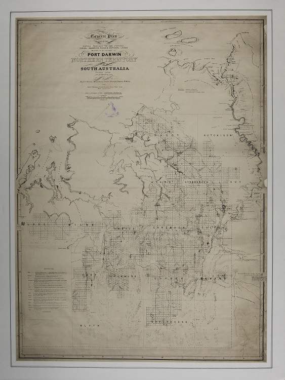
Image 2: 13A_NTL-Rare_Map_67 Surveying Darwin 1869
Lee Point and the Defence of Darwin
Lee Point played an important role in the defence of Darwin during World War II and Indonesian confrontation in the 1960s.
In early 1941 the area was used as a defensive position for the expected Japanese invasion. The beaches from Rapid Creek north were fortified by barbed wire and trenches, gun positions were constructed at Lee Point and Dripstone Caves, which also was the location for the No 31 RDF Station. The weapon pits and machine gun posts were manned by the 23rd Australian Infantry Brigade on the beaches (Rayner 1995, Heritage Surveys 2001).
The Indonesian confrontation led to gun placements for sea and antiaircraft defence, plus installation of (up to 8) Bloodhound missiles, at Lee Point.
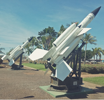
Image 3: The Bloodhound was a mid to high altitude Surface to Air missile, range 190km, max speed ~2700km/hr.
In the early 1950s the Department of Defence acquired Block 4873 to establish a radar and receiving station (Heritage Surveys 2001) and by the 1960s there were numerous buildings surrounded by earth and sand embankments. These activities were related to the strengthening of the defensive forces in Darwin during the period of hostilities between Indonesia and Malaysia in 1963 (Alford 2004) and when the Indonesian Air Force violated Australian airspace. These activities included the permanent detachment of No 30 Squadron RAAF between 1965 to1968, a twelve gun battery which provided anti aircraft and seaward defences, six Bofors guns, surrounded by several two gun weapon pits, and the placement of Bloodhound MK1 surface to air missiles (SAM). No121 LAA was specifically formed as part of the 16 Air Defence Regiment for the Defence of Darwin during the Indonesian incursions. The radar station during this period was manned by the RAAF’s 2CRU (Central and Reporting Unit) The site, until recently, was used as a radar facility by the Department of Defence. The existing buildings consist of workshops, two towers and the remains of aerials.
Cruciform
A heritage assessment, detailed investigation and excavation was made on one of the Bofors anti-aircraft gun emplacements located south of Block 4873 (Alford 2004, 2005, De la Rue 2004) before it was destroyed. This site was considered to be notable because of its association with the tensions with Indonesia in the 1960s and the distinctive unusual shape. The emplacement consisted of a hollow cruciform arrangement of earth filled 44 gallon drums which were banked around the outside by earth. De la Rue (2004) considered that this shape is most suitable for 40mm Bofors anti-aircraft L/60 anti aircraft gun
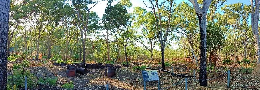
Image 4: Cruciform at Lee Point
Lee Point ceased to be used for military purposes in the early 2000’s.
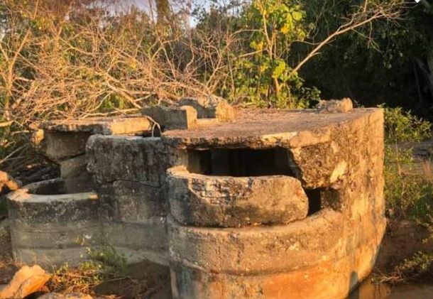
Image 5: Bunker at Lee Point