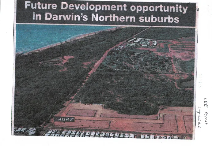
Key Visual Markers Confirming the Era
- Foreground Civil Works (Lyons / Muirhead Interface): The bottom of the image shows completed suburban streets at the bottom edge, transitioning directly into newly pegged and carved-out earthworks. Lyons construction began around 2004, while Muirhead civil works commenced around 2011. The visible grid preparation at the lower right captures this exact transition phase.
- Lot 12743 Identifier: The overlay pin points to Lot 12743 (Town of Nightcliff), the major land parcel north of Muirhead along Lee Point Road. This specific lot designation was heavily featured in Northern Territory Land Corporation and Defence Housing Australia (DHA) preliminary development notices and expressions of interest during the 2008–2014 period.
- Lee Point Road Corridor: Lee Point Road runs directly up the center of the frame toward the coast. The surrounding vegetation shows the original, dense bushland prior to any major site clearing for the DHA master-planned community.
- Top-Right Facilities: The Lee Point Resort / Caravan Park layout and surrounding cleared paddocks are clearly visible near the top right, before any later modern redevelopment in that immediate pocket.
The photo captures the boundary of Darwin’s northern growth corridor right at the moment the transition from Lyons/Muirhead into the broader Lee Point peninsula planning framework was being publicly advertised.