Submission on Kulaluk–Minmarama Assessment Report: Development in Primary Storm Surge Zones
Hello Gemma, Ann-Marie
Thank you for your emails. There are still many concerned residents, and it can be expected that a piecemeal approach to development in the area will lead to more community upset. The use of “rolling approvals” is now more obvious than ever. It would be reasonable for community to expect a new fresh evaluation of “sleeper” projects which were obviously never going to get actioned in the funding drought of the last ten years. A highlight is being thrown on the lack of current released flood zone information for the whole of the Darwin region.
To: Development Assessment Services
Department of Infrastructure, Planning and Logistics
Cc: Development Consent Authority (Darwin Region)
Subject: Clarification Request – Status and Scope of Development Permit DP14/0831 (Lot 5182, Dick Ward Drive – SD37 Zone)
Background and Purpose
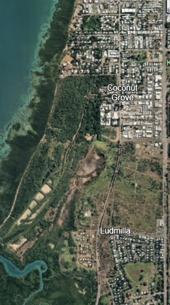
The Planning Action Network (PLAN) writes to seek clarification on the current status and technical basis of Development Permit DP14/0831, relating to Lot 5182, Town of Darwin (213 Dick Ward Drive – Specific Use Zone SD37).
Permit History
Permit records show that DP14/0831 was originally issued in 2014 and has since been varied nine times (DP14/0831 A–H) and extended to 4 December 2026. The most recent variation (April 2025) was granted under section 57(3) of the Planning Act 1999 for the purpose of removing one condition precedent, with the decision stating:
“In all other respects Development Permits DP14/0831, DP14/0831D and DP14/0831F remain unchanged.”
(DP14/0831 H, Attachment B – SD37 Permit)
April 2025 Variation and Restaging
The April 2025 variation also restages the subdivision from two stages to three. PLAN seeks clarification on whether this amendment changes the sequencing of infrastructure delivery or environmental management obligations. The staging of a subdivision determines when conditions such as drainage, storm-water works, and buffer or landscaping requirements must be implemented. A restaging can therefore affect the timing of essential works or defer requirements that were previously to be completed earlier in the project. PLAN requests clarification on how the Department has assessed the implications of the restaging under section 57(3) of the Planning Act 1999, including whether any timing of conditions or sequence of infrastructure delivery has been altered through the amendment.
Proponent and Land Tenure Context
PLAN notes that the Byrne Land Assessment Report (2023) records a “Right-of-Way Easement to Citiland Corporation Pty Ltd” over part of CLP 671 but does not identify any registered sub-lease. The same report identifies Areas 8 and 9 as “Citiland (Jape)” commercial/light-industrial areas with an active permit (DP14/0831) for land bounded by Bagot Road, Fitzer Drive and Dick Ward Drive. For clarity, PLAN seeks confirmation whether Citiland Corporation Pty Ltd is acting as the current proponent for DP14/0831 with the consent of the Gwalwa Daraniki Association as landholder.
Current Technical Basis
The current permit requires that prior to any works the proponent submit an updated Erosion and Sediment Control Plan (ESCP) and Environmental Construction Management Plan (ECMP), but it does not appear to call for any new hydrology, drainage or storm-surge studies. The underlying technical basis therefore appears to remain that of the original 2014 application.
Relevance of the Current Planning Scheme
PLAN further notes that the 2014 permit was assessed under the NT Planning Scheme 2007, whose focus was zoning and engineering practicality. The NT Planning Scheme 2020 now requires a broader range of assessments for new subdivisions or fill proposals, including:
– Coastal and flood modelling in accordance with the NT Coastal Hazards Technical Guideline (2020);
– An Integrated Storm-Water Management Plan that satisfies the Darwin Harbour Water Quality Objectives (2021);
– A climate-risk and heat-mitigation study addressing canopy and micro-climate resilience;
– A biodiversity and vegetation assessment aligned with the Darwin Urban Habitat Conservation Strategy (2023); and
– A current AAPA certificate confirming cultural-heritage clearances.
Requests for Clarification
PLAN respectfully requests written confirmation of the following points:
1. Whether the hydrological, storm-water and traffic studies prepared for the 2014 application remain the operative technical documents;
2. Whether any updated assessments have been required by the Department or the DCA to address changes in planning policy, climate data or engineering standards since 2014; and
3. Whether any further public notification will occur if new or revised technical material is lodged under the current permit cycle.
PLAN seeks clarification on whether these modern assessment requirements have been applied to the current variation of DP14/0831, or whether the project continues to operate solely on the technical documentation accepted in 2014.
Closing Statement
This request is made to ensure the public record remains accurate and to maintain confidence in the transparency and integrity of the Territory’s planning process.